
California's Drought Improving
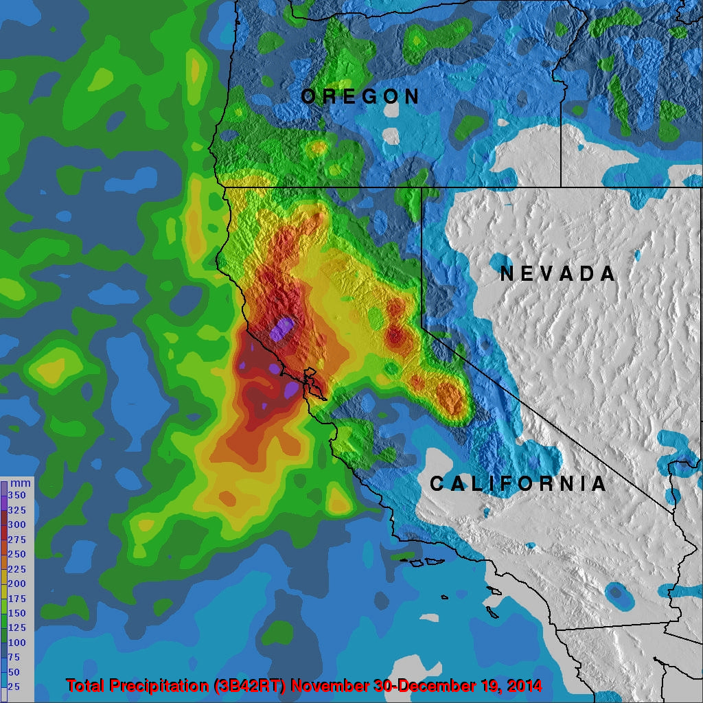
Waves of rainfall from Pacific Ocean storms show signs of improving the exceptional drought conditions that have been plaguing California. Starting on about November 30, 2014 storms frequently moved over California. A Multi-satellite Precipitation Analysis (MPA) using data (3B42) archived at near "real time" at the NASA Goddard Space Flight Center was used in the analysis. It indicates that northern California has had far more beneficial rainfall than southern California. This analysis shows that storms dropped over 350mm (almost 14 inches) in an area north of San Francisco. Southern California rainfall totals were much lower.
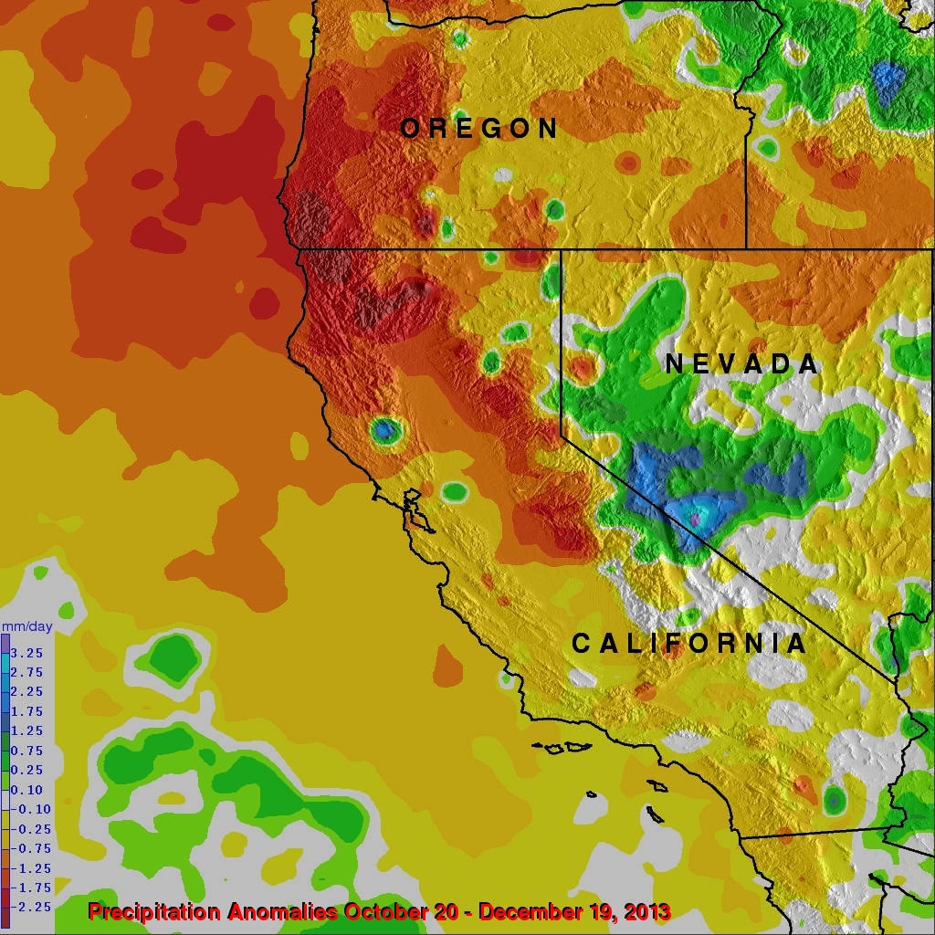
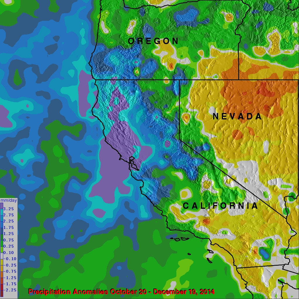
The first image shows a rainfall anomaly analysis that was made by comparing rainfall data (3B42) collected for the period from October 20 to December 19, 2013 to rainfall data compiled during the twelve year period from 2001-2012. The second precipitation anomaly analysis is a comparison to satellite rainfall data archived during the past two months (October 20 to December 19, 2014). This anomaly analysis shows that northern California has benefited while much of Nevada received little drought alleviating precipitation.