
Cristina Now A Hurricane
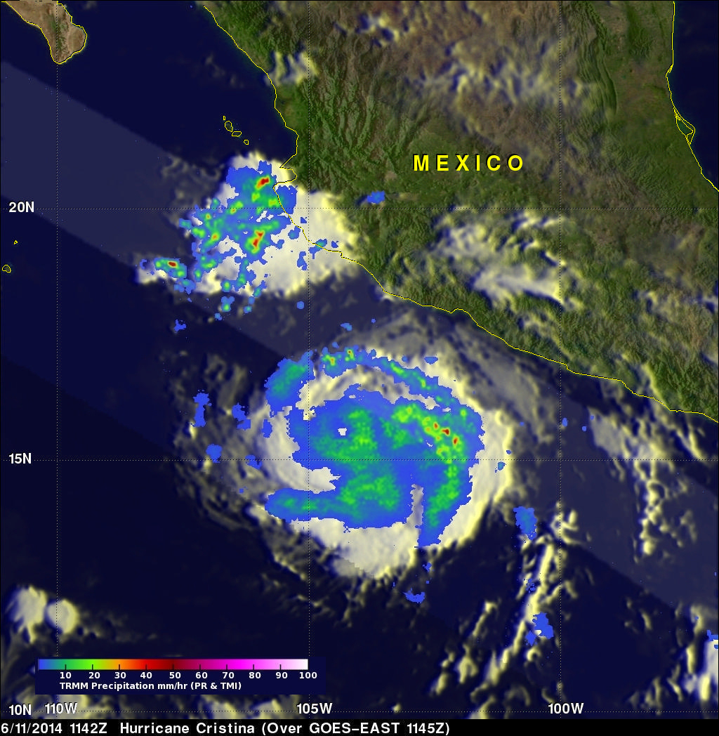
Tropical storm Cristina intensified and was a category one hurricane with wind speeds of over 65 kts (about 75 mph) when the TRMM satellite flew over on June 11, 2014 at 1142 UTC (4:42 AM PDT). A rainfall analysis that used data from TRMM's Microwave Imager (TMI) and Precipitation Radar (PR) instruments is shown overlaid on an enhanced infrared image received by the GOES-EAST satellite at 1145 UTC. TRMM TMI data clearly revealed that an eye had developed indicating that Cristina was definitely a hurricane. TRMM PR found that rain was falling at a rate of over 74.4 mm/hr (about 2.9 inches) in a strong feeder band east of Cristina's eye. Another smaller area of strong convective thunderstorms west of Puerto Vallarta, Mexico was also found to contain very heavy rainfall with the tallest thunderstorm tops reaching heights of about 16.5km (about 10.2 miles).
Click here to see a Low Resolution 512x512 Quicktime animation showing TMI/PR rainfall overlaid on GOES.
Click here to see a Low Resolution 512x512 MPEG animation showing TMI/PR rainfall overlaid on GOES.