
Cristobal Passes Northwest Of Bermuda
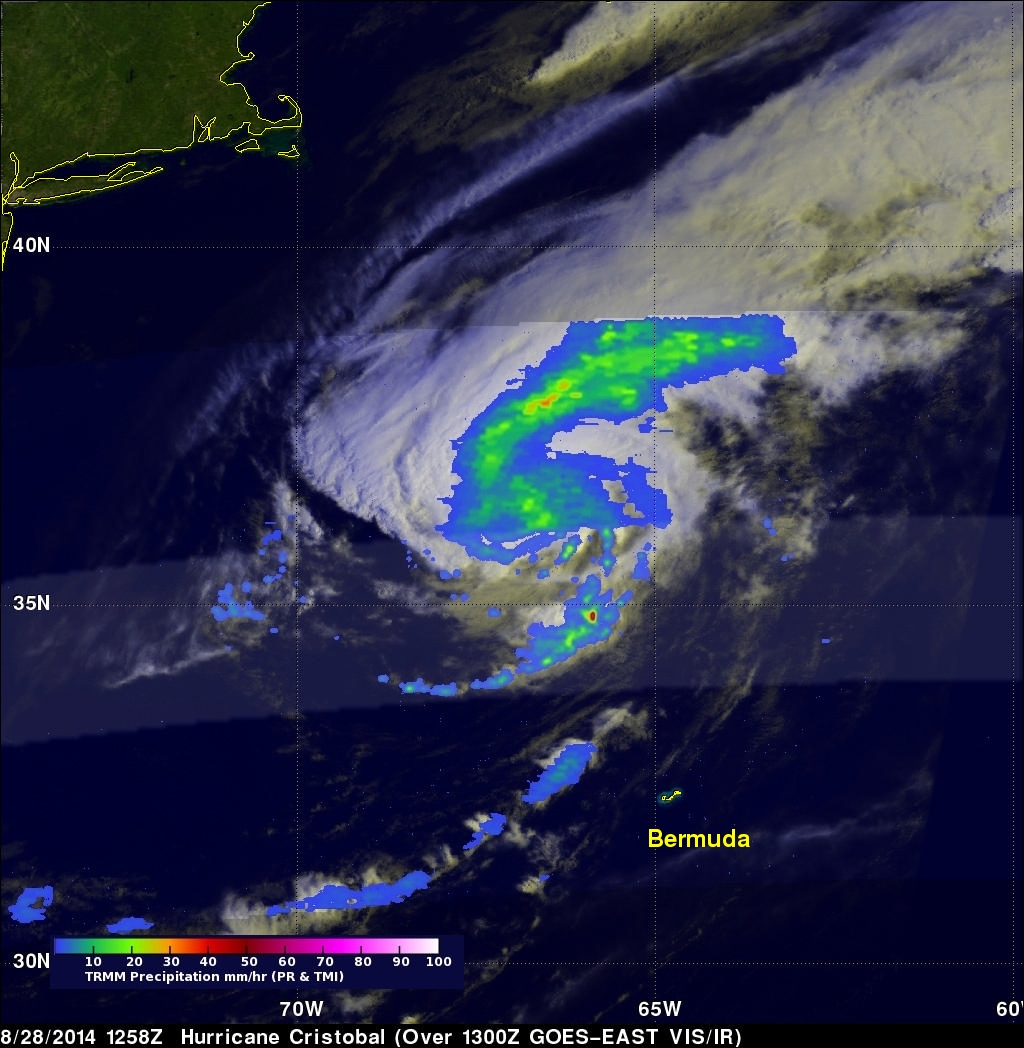
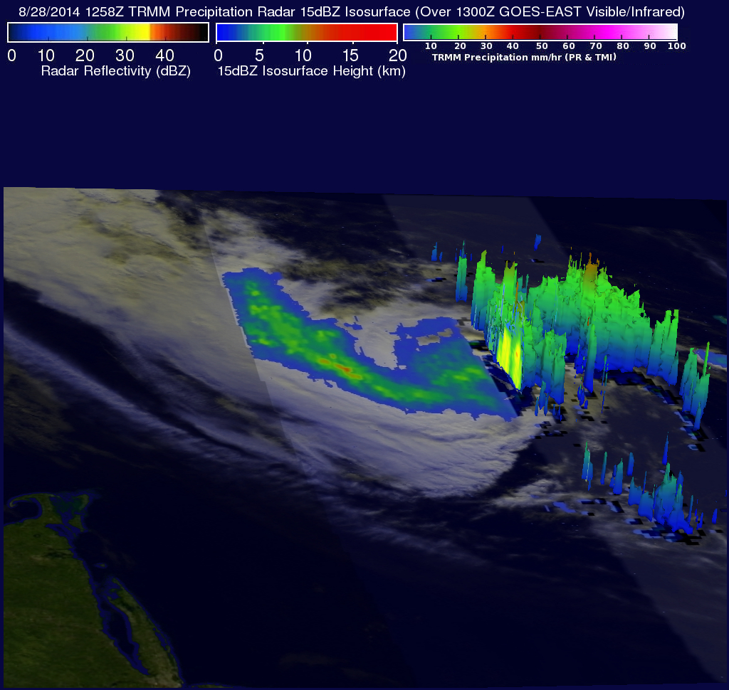
The TRMM satellite had a very good view of Cristobal on August 28, 2014 at 1258 UTC (8:58 EDT) as the hurricane passed well to the northwest of Bermuda. Rainfall derived from TRMM's Microwave Imager (TMI) and Precipitation Radar (PR) data is shown overlaid on a 1300 UTC GOES-EAST Visible/Infrared image. TRMM PR found some intense thunderstorms producing rain at a rate of almost 78 mm (about 3.1 inches) per hour in a band of precipitation feeding into Cristobal's southeastern side. The next image is a simulated 3-D view (from the west) of Cristobal's rainfall structure using radar reflectivity data from TRMM's Precipitation Radar (PR) instrument.
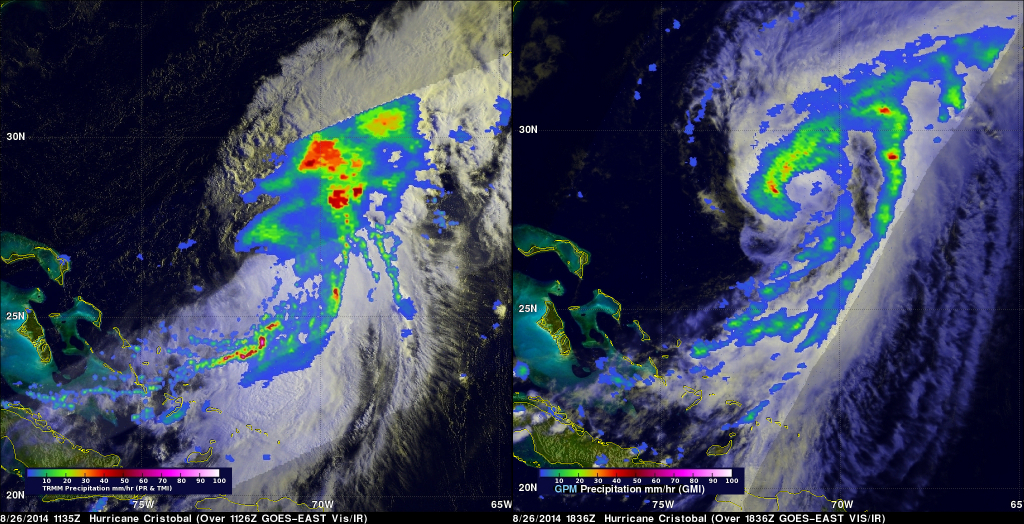
TRMM was close to reaching it's northern most coverage when the satellite flew over on August 28, 2014. The GPM satellite launched by NASA and JAXA on Feb. 27, 2014 will continue viewing hurricane Cristobal as the tropical cyclone moves farther north over the open waters of Atlantic Ocean. The images above show rainfall derived from the TRMM and GPM satellites using data collected on August 26, 2014 at 1135 and 1836 UTC. The image on the right shows a rainfall analysis using data collected by the GPM Microwave Imager (GMI) instrument overlaid on a 1838 UTC GOES-EAST Visible/Infrared image.