Cyclone Hudhud Makes Landfall, Brings Potential for Heavy Rains to Himalayas
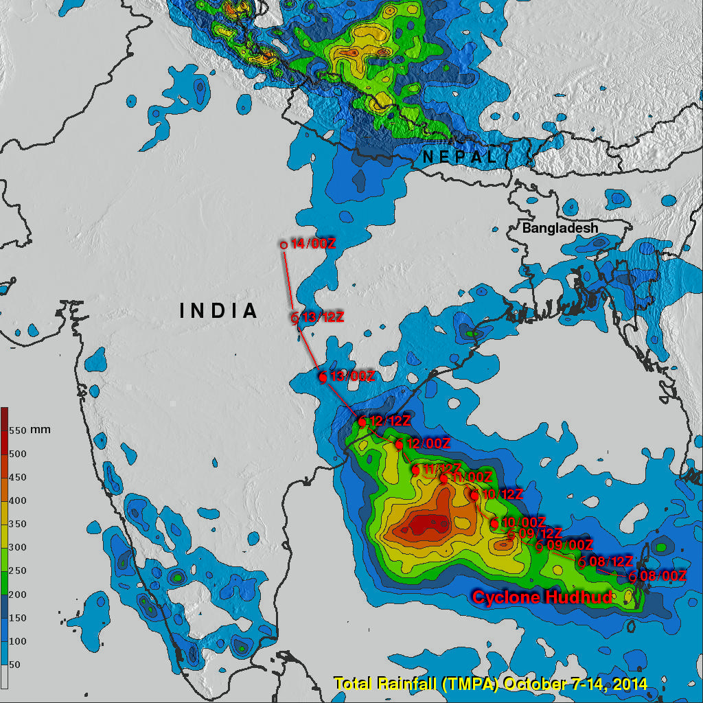
Cyclone Hudhud, which reached the equivalent of a category 4 hurricane on the US Saffir-Simpson scale over the Bay of Bengal, weakened slightly before making landfall Sunday morning (local time) on the central southeast coast of India near the port city of Visakhapatnam. Hudhud came ashore with wind gusts of up to 120 mph and so far is being blamed for 24 fatalities in India. The TRMM-based, near-real time Multi-satellite Precipitation data (TMPA) analysis is used to monitor rainfall over the global Tropics. A TMPA rainfall analsis for the period 7-14 October 2014 over India and the surrounding region shows the rainfall associated with the passage of HudHud (storm symbols denote the track and intensity of Hudhud). Rainfall totals are highest over the open ocean where upwards of 550 mm (~22 inches, dark red) may have fallen; over land, the highest totals are 200 to 250 mm (~8 to 12 inches, green) and are along the coast near where Hudhud made landfall. Farther inland, the amounts of are lower, generally on the order of 50 to 100 mm (~2 to 4 inches, blue); however, as the remnants of Hudhud continue to track closer to the foothills of the Himalayas, the surge of moisture associated with Hudhud is acting to reinvigorate the monsoon and has started to bring heavy rains to parts of Nepal and northern India.


