
Deadly Tornadoes Hit Southern and Central US
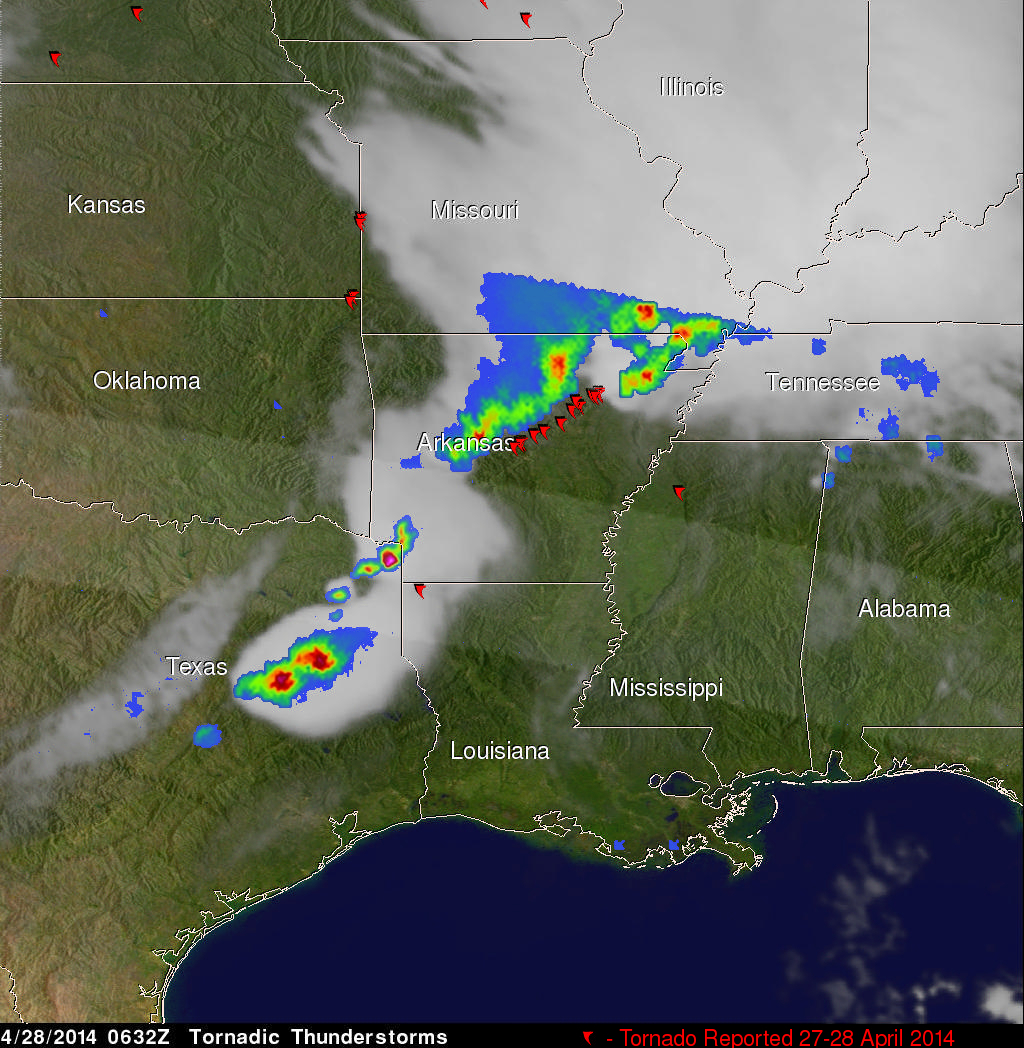
The TRMM satellite flew over the southern United States on April 28, 2014 at 0454 UTC (April 27, at 11:54 CDT) and April 28, 2014 at 0632 UTC (1:32 AM CDT). At both times severe weather pushing through the central and southern United States was observed by the satellite. Tornadoes associated with these areas of powerful thunderstorms killed at least 16 people with 14 deaths reported in Arkansas.
Rainfall from TRMM's Microwave Imager (TMI) and Precipitation Radar (PR) instruments is shown above overlaid on GOES-EAST infrared satellite images received at close to the same time. The locations of tornado reports from Sunday evening through Monday morning are noted with red tornado symbols. TRMM PR found rain falling at the extreme rate of almost 171 mm/hr (about 6.7 inches) in a line of intense storms moving through northwest Arkansas with the first TRMM observation. This same line was returning radar reflectivity values of nearly 61 dBZ to the satellite. With the later view TRMM found rain falling at a rate of over 146 mm/hr (about 5.7 inches) and values of over 59 dBZ reflectivity values in an area near the Arkansas and Texas border.
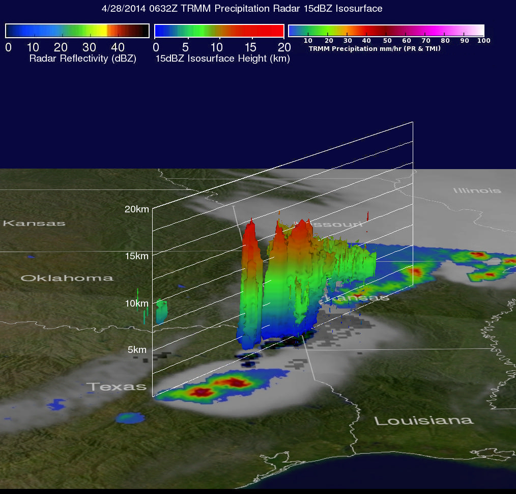
Data captured with TRMM's Precipitation Radar (PR) on the 0632 UTC (1:32 AM CTD) pass were used in this 3-D view that found thunderstorm tops reaching altitudes above 15km (about 9.3 miles).