
Deadly Tropical Cyclone Giovanna Floods Madagascar
The rainfall analysis above uses near-real-time, TRMM-based precipitation estimates (3B42)from a merger of all available satellite data. This Multi-satellite Precipitation Analysis (TMPA) done at the NASA Goddard Space Flight Center provides estimates of rainfall over the global Tropics. This rainfall analysis shows the rainfall from February 8-15, 2012 that was mainly caused by tropical cyclone Giovanna when it passed over Madagascar. This analysis indicates that the highest rainfall totals of over 250mm (~10 inches) fell in the coastal area east of Madagascar's capitol of Antananarivo. In that area people were flooded out of their homes and deaths have been reported.
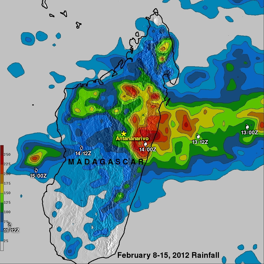
White symbols show the times and locations of tropical cyclone Giovanna as it passed over Madagascar.