
Deadly Tropical Cyclone Lusi
Tropical cyclone LUSI recently caused the deaths of at least three people as it moved through the island nation of Vanuatu in the South Pacific Ocean.
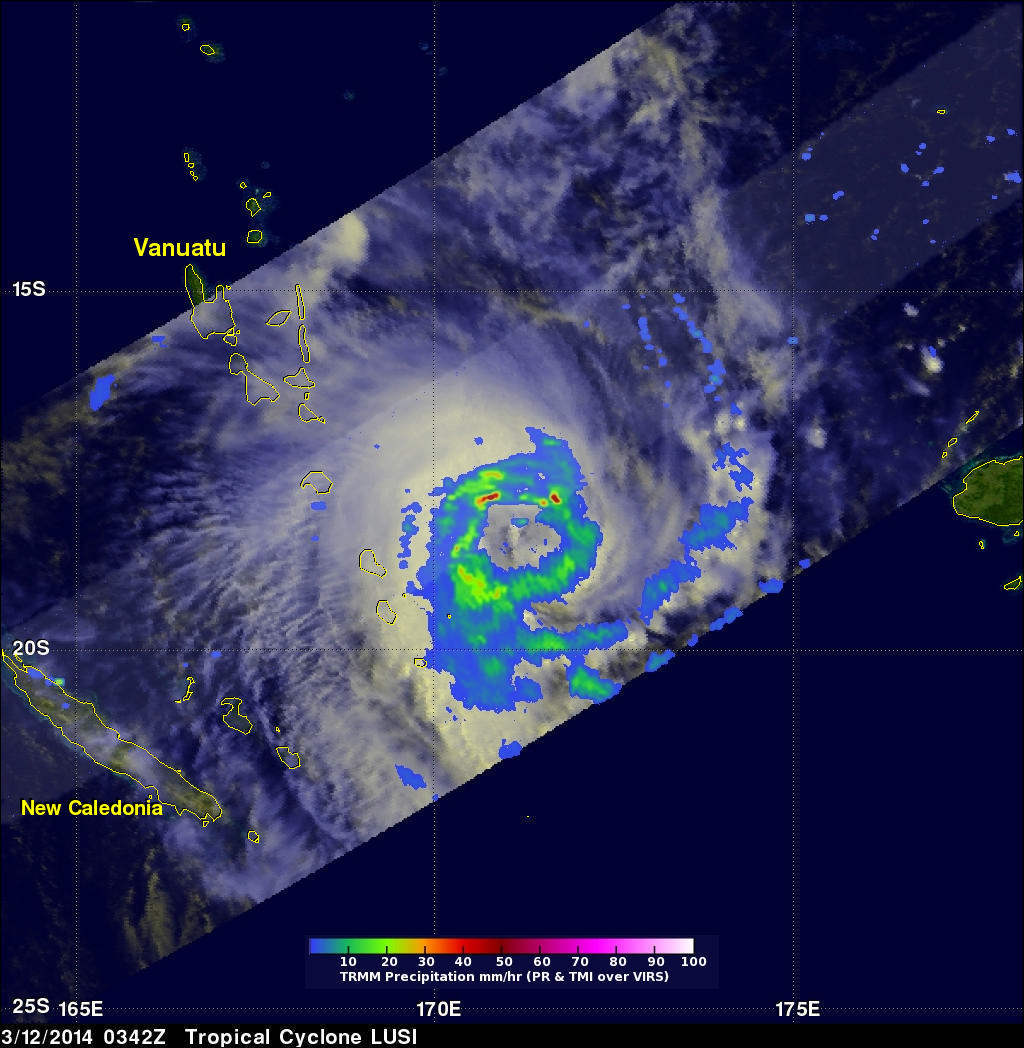
The TRMM satellite flew above tropical cyclone LUSI on March 12, 2014 at 0342 UTC. A rainfall analysis made from TRMM's Microwave Imager (TMI) and Precipitation Radar (PR) data is shown overlaid on an enhanced visible/infrared image from TRMM's Visible and InfraRed Scanner (VIRS). TRMM PR data revealed with this analysis that rain was falling at a rate of over 97 mm/hr (~3.8 inches) in rain bands rotating around LUSI's center.
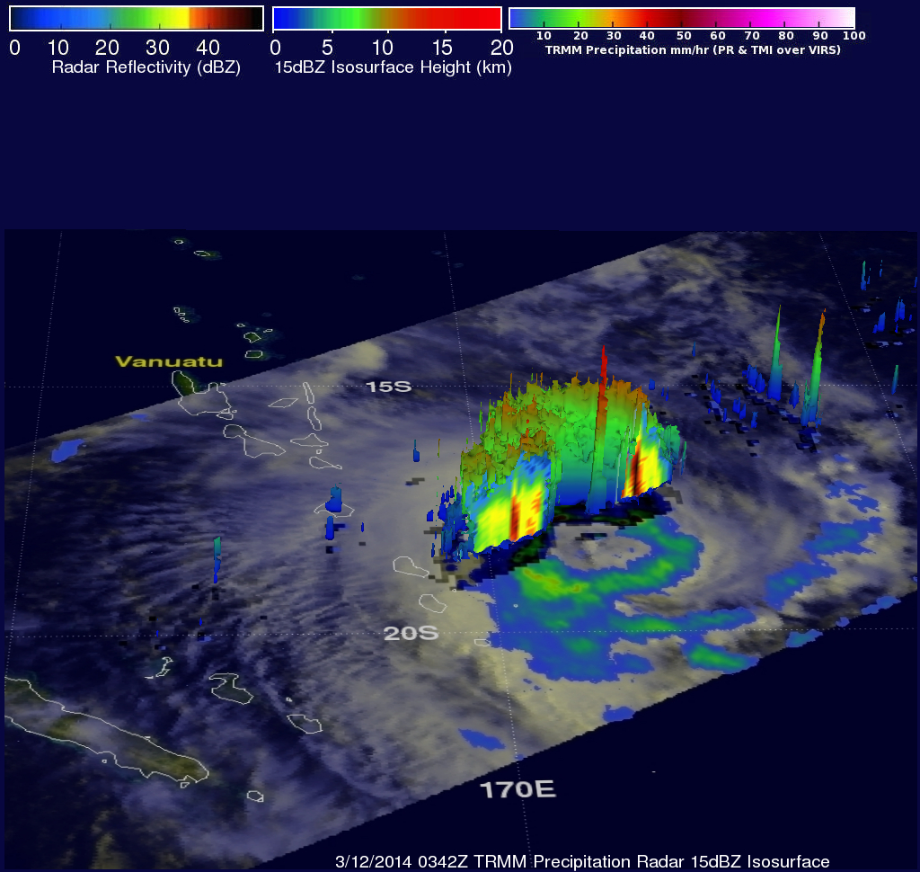
TRMM's Precipitation Radar (PR) data were used in the image above to show the 3-D structure of precipitation within tropical cyclone LUSI. Some of the strong convective thunderstorms in the ring of storms around LUCI's center were returning reflectivity values of 50 dBZ to the satellite. A few isolated thunderstorm towers near LUSI's center were found to reach heights above 16km (~9.9 miles).
LUSI had winds estimated at close to 60kts (~69 mph) at the time of this TRMM pass. The tropical cyclone is predicted to reach peak intensity with winds of about 75kts (~86 mph) in about 24 hours. Gradual weaking is expected then before it affects northern New Zealand in a few days.