Deadly Tropical Cyclone Mahasen Comes Ashore
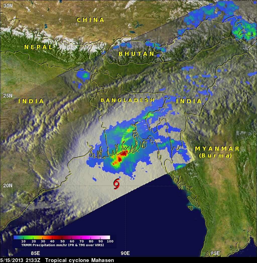
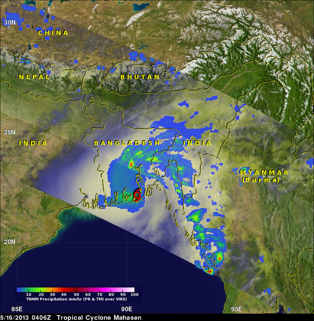
Tropical cylone Mahasen hit southern Bangladesh causing the reported deaths of at least 12 people and the destruction of many homes. Mahasen had heavy rains accompanied with tropical storm force winds when it came ashore. The TRMM satellite had two very informative views as deadly tropical Cyclone Mahasen was moving toward and then over Bangladesh. TRMM passed above Mahasen on May 15, 2013 at 2133 UTC and saw Mahasen again on May 16, 2013 at 0406 UTC after the tropical cyclone's center passed over Bengladesh's Ganges Delta. Red tropical cyclone symbols mark Mahasen's locations with both TRMM passes. With the first orbit TRMM's Precipitation Radar (PR) found rain within Mahasen falling at a rain of over 67mm/hr (~2.6 inches) and at a rate of over 57mm/hr (~2.25 inches) with the later view.
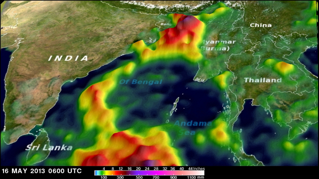
The below image shows a simulated 3-D analysis of TRMM Multisatellite Precipitation Analysis (TMPA) of rainfall that occurred with tropical cyclone Mahasen during the period from May 6-16, 2013 as tropical cyclone Mahasen was making it's deadly transit through the Bay Of Bengal. Rainfall from Mahasen is only adding to flooding rainfall that had already occurred in the area. Rainfall totals of about 544mm (~21.4 inches) were found with this analysis over Bangladesh and north-east India.