
Deadly Typhoon Nesat Hits The Philippines
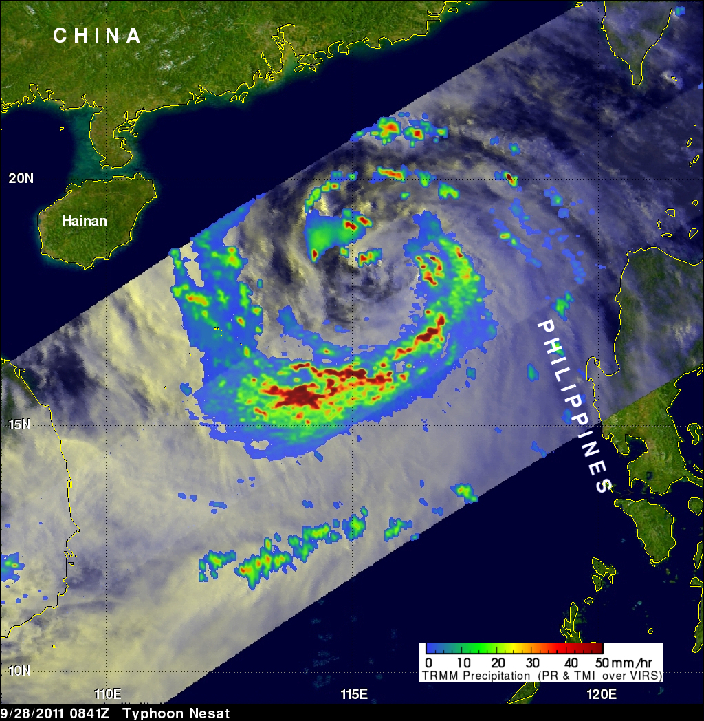
Powerful typhoon Nesat (known locally as Pedring) came ashore in the Philippines on Tuesday September 27, 2011 causing the deaths of at least 33 people. Nesat was classified as a category three typhoon on the Saffir-Simpson scale with winds of 105 knots (~121 mph) before hitting the island of Luzon.
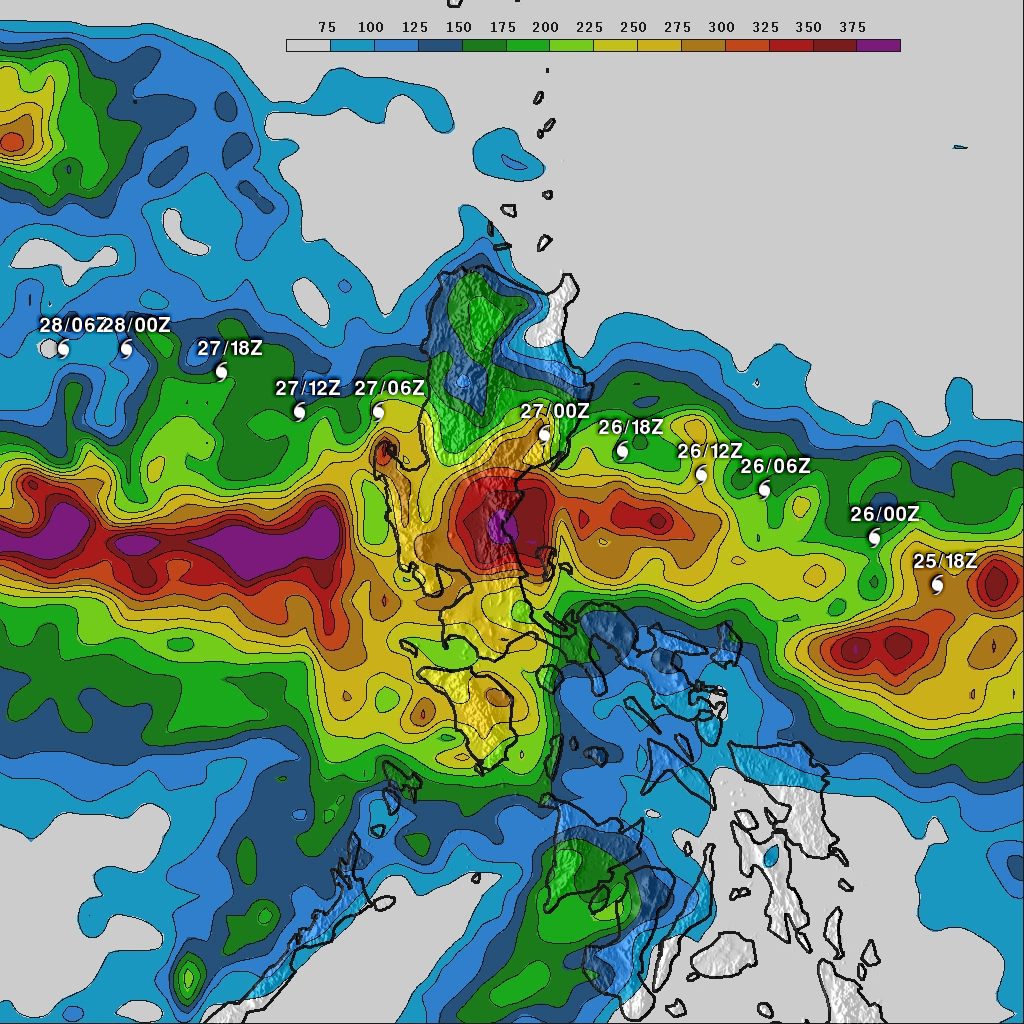
The rainfall analysis above is the result of a TRMM-calibrated merged global Multi-satellite Precipitation Analysis (MPA) performed at Goddard Space Flight Center (GSFC). These MPA rainfall total estimates were for the period from 24-29 September 2011. This analysis indicates that the highest rainfall totals of over 375 mm (~14.8 inches) were centered over Luzon's central eastern coast, south of Nesat's track. This analysis reveals that most of Luzon experienced very heavy rainfall during this period with large areas of Luzon having totals higher than 150 mm (~5.9 inches.
Typhoon Nesat's track is shown with white typhoon symbols. The rainfall analysis shows that Nesat continued to produce heavy rainfall after it entered the South China Sea and headed westward toward southern China.
Click here to see earlier TRMM related information about typhoon Nesat.