Eastern Pacific Category Four Hurricane Amanda
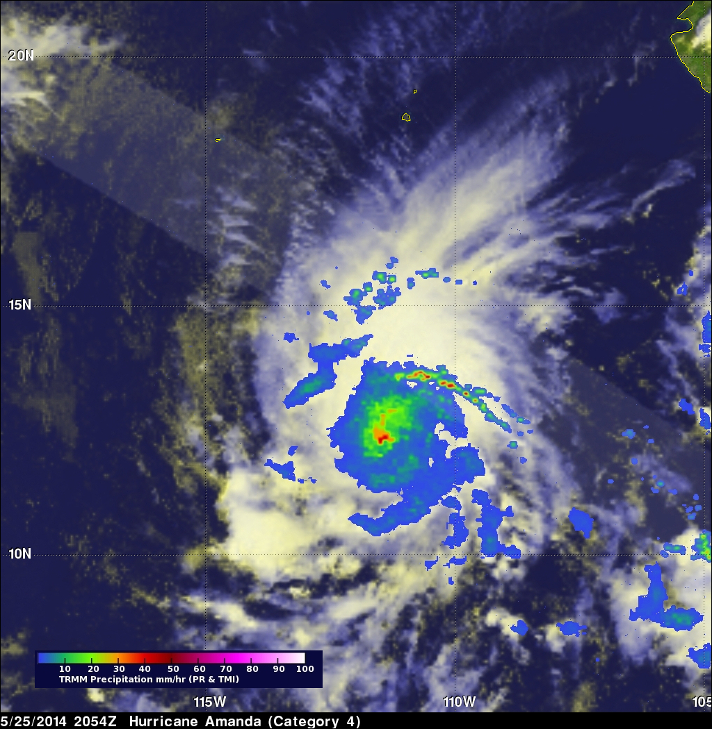
The first hurricane of the eastern Pacific hurricane 2014 season, called Amanda, reached wind speeds estimated at 135 kts (about 190 mph) on May 25, 2014. This made it a category four on the Saffir-Simpson hurricane wind scale. Fortunately the powerful hurricane was over open waters well to the southwest of Mexico's coast when the maximum intensity was reached.
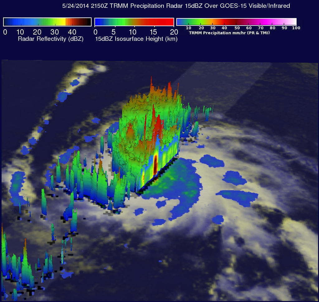
The images above show data collected when the TRMM satellite passed overhead on Saturday May 24, 2014 at 2150 UTC. Rainfall data from TRMM's Microwave Imager (TMI) and Precipitation Radar (PR) instruments are shown overlaid on a GOES-15 visible/infrared image received at 2200 UTC. This was about six hours after Amanda was upgraded to a hurricane. At that time Amands had winds of about 70 kts (about 80.5 mph). TRMM's Precipitation Radar (PR) instrument had an excellent view of the rain falling at a rate of over 147 mm/hr ( about 5.8 inches) in the northwestern side of the Amanda's eye wall. Intense storms in that area were reaching heights of over 16.3 km (about 10.1 miles).
Click here to see a Low Resolution 640x360 simulated 3-D (Quicktime) flyby.
Click here to see a Low Resolution 640x360 simulated 3-D (MPEG) flyby.
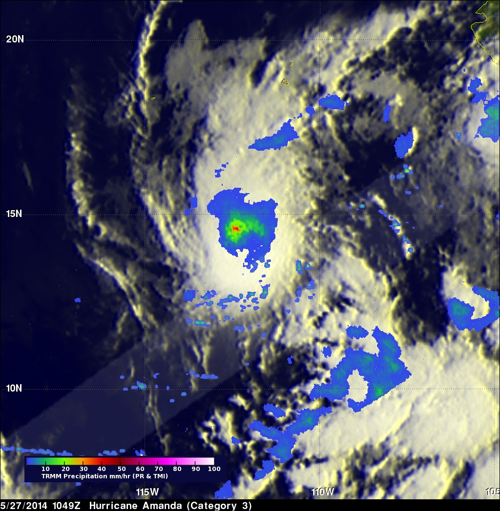
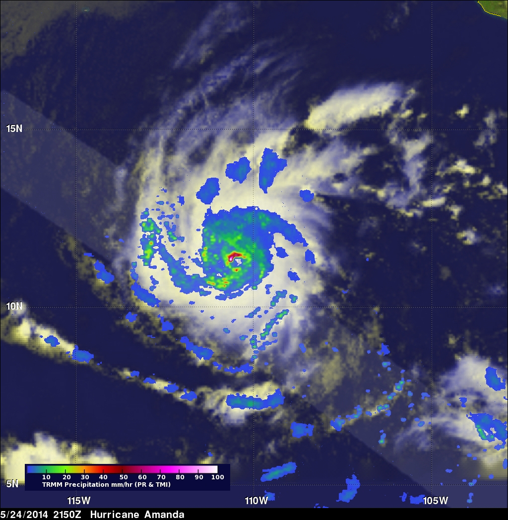
The TRMM satellite had two other good views of hurricane Amanda on Sunday May 25 at 2054 UTC and on Tuesday May 27 at 1049 UTC. Hurricane Amanda had winds speeds estimated at 130 kts (about 150 mph) at the time of the image above. Amanda had weakened slightly but was still a very strong hurricane with winds of about 110kts (about 127 mph) at the time of the below image.
Hurricane Amanda is predicted to continue weakening while heading toward the northeast and be a tropical depression on May 31, 2014.