
Extreme Rainfall from Tropical Storm Lee
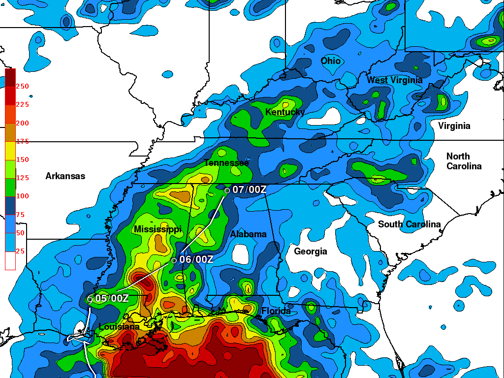
The rainfall analysis above is from TRMM calibrated precipitation estimates called Multi-satellite Precipitation Analysis (MPA). This product was developed by the precipitation research team in the Laboratory for Atmospheres at NASA Goddard Space Flight Center and uses satellite data collected in "real time"(3B42 ). This preliminary analysis shows the estimated total rainfall measured for the period from 30 August to 6 September 2011 and includes rainfall from other sources including tropical storm Lee. Tropical storm Lee has been dropping heavy rain since moving over land from the Gulf Of Mexico on Sunday 4 September 2011. Extreme rainfall totals of over 250 mm (~9.8 inches) occurred over Lousiana and Mississippi as Lee moved slowly northeastward. Lee's approximate historical and forecast locations are shown with a white overlay.