Freda Brings Heavy Rains to New Caledonia
After forming just south of the Solomon Islands on the evening of December 28th (local time), Cyclone Freda moved southward and intensified, becoming a strong Category 3 cyclone on the 30th. As the storm continued to move south, it weakened significantly and approached the island of New Caledonia on the 2nd of January 2013 as a tropical storm. TRMM captured this image of Freda at 07:16 UTC (6:16 pm local time) 2 January 2013. The image shows an instantaneous snap shot of the rain intensities within Freda. Rain intensities in the center of the swath are from the TRMM Precipitation Radar (PR) and those in the outer swath from the TRMM Microwave Imager (TMI). The rain intensities are overlaid on visible and IR data from the Visible Infrared Scanner (VIRS).
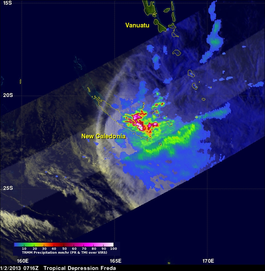
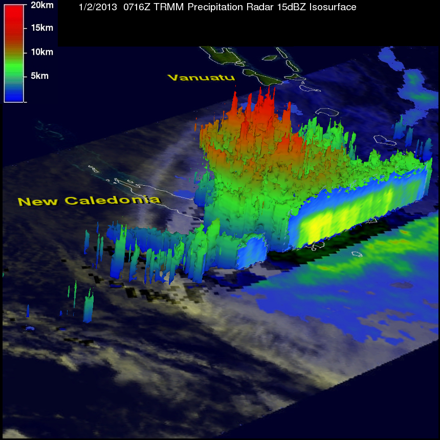
TRMM shows most of the heavy rain is occurring along the southeast side of New Caledonia where the clockwise flow around Freda is coming on shore. New Caledonia has a central mountain range that runs down the length of the island, providing an ideal situation for orographic enhancement of precipitation. The second image, taken at the same time, shows a 3D view of Freda courtesy of the TRMM PR. The view is looking north. The red shading show areas of deeper convection associated with stronger thunderstorms embedded within Freda's circulation. They are associated with the areas of intense rain shown in the previous image.