
GPM And TRMM See Glenda At Same Time
Tropical storm GLENDA formed over the open waters of the South Indian Ocean southeast of Diago Garcia on February 24, 2015. GLENDA didn't get above tropical tropical storm intensity and has not posed a significant threat to islands in the area. An interesting event occurred on February 25, 2015 when both the TRMM satellite and it's successor the GPM core observatory satellite passed over the tropical cyclone at almost the same time.
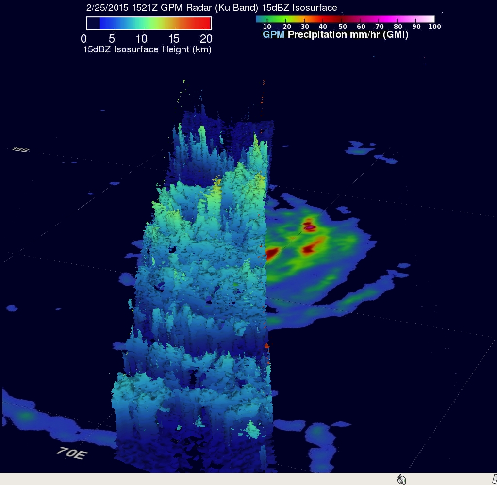
This 3-D view was constructed from GPM Radar data (Ku Band) collected with the 1521 UTC pass. It shows the vertical structure of tropical storm GLENDA along the GPM swath. Those reflectivity data collected with this pass show that some storm top heights were reaching heights above 11 km (6.8 miles)
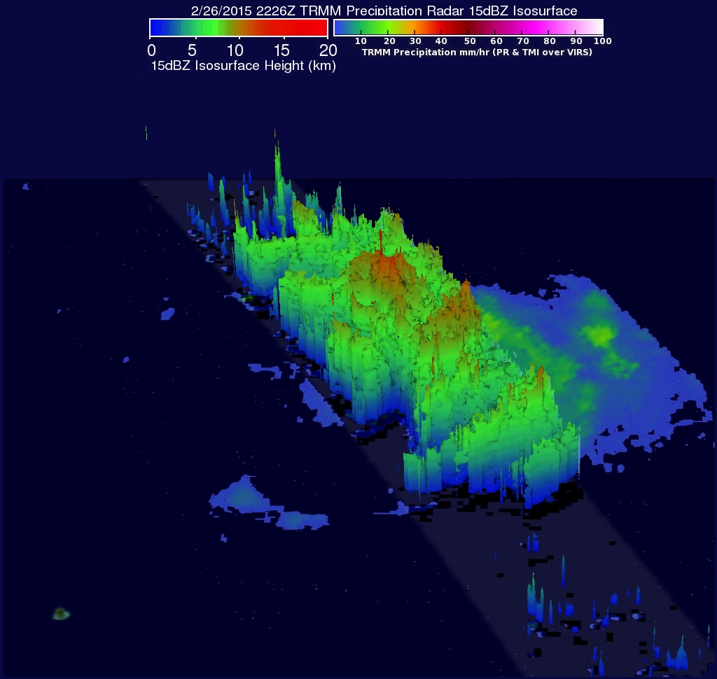
The TRMM satellite again had a good look at cyclone GLENDA when it passed over on February 26, 2015 at 2226 UTC. A composite of rainfall from TRMM's Microwave Imager (TMI) and Precipitation Radar (PR) shows that GLENDA had very little rainfall near the center of circulation but heavy rainfall was located by TRMM PR (lighter shades) within intense bands of rainfall around GLENDA's southeastern side. A 3-D view from TRMM PR reflectivity data indicated that some of these intense storms had storm top heights of over 16.7 km (10.3 miles).
The Joint Typhoon Warning Center (JTWC) predicts that GLENDA has passed it's peak intensity and will continue to weaken as it heads toward the south-southeast over the open waters of the South Indian Ocean.