
GPM Looks Into Cyclone Joalane's Eye
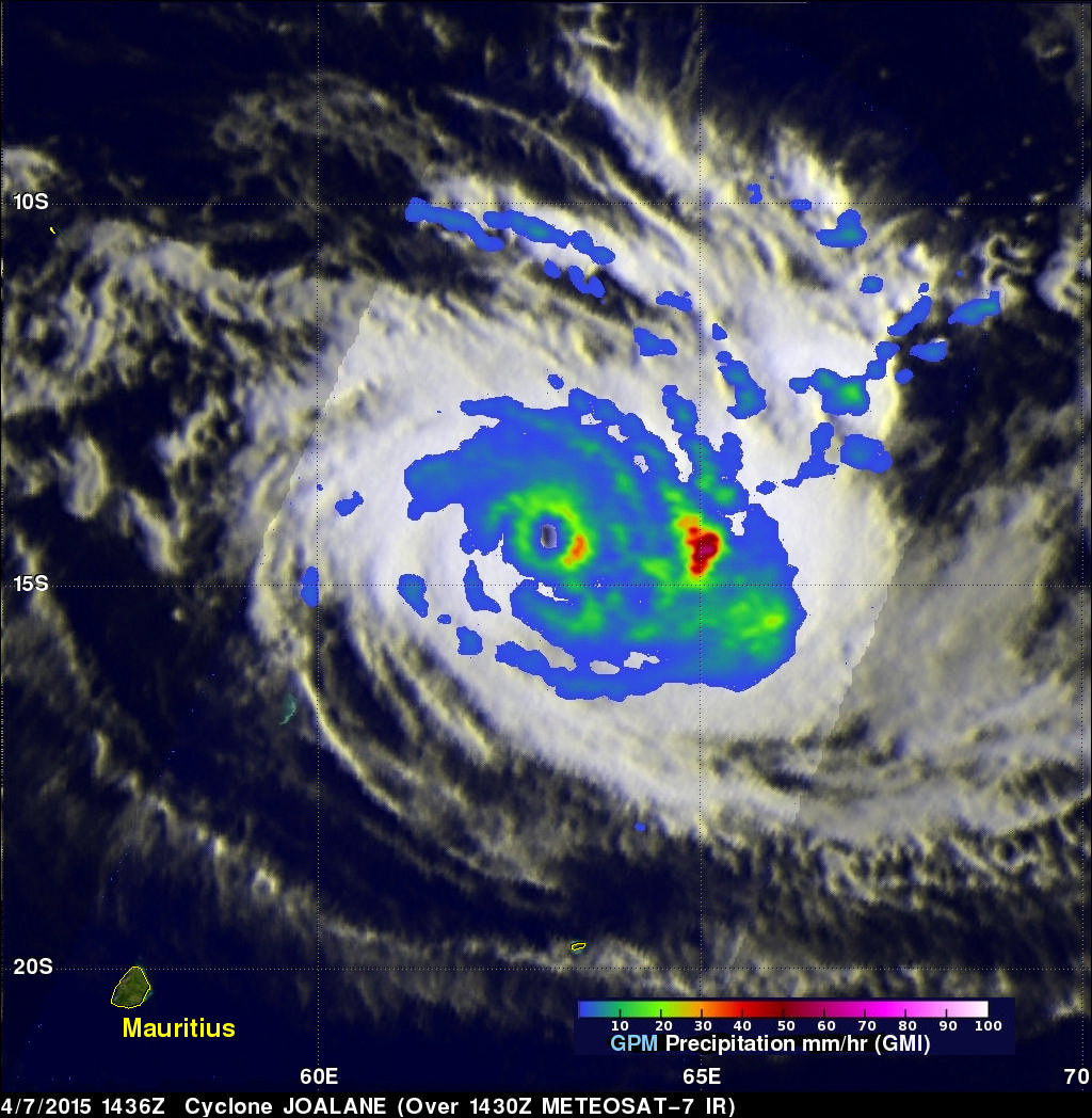
Cyclone Joalane had developed a small clear eye when the GPM core observatory satellite passed above on April 7, 2015 at 1436 UTC. GPM's Microwave Imager (GMI) data showed that the heaviest rain was falling at a rate of over 78.6 mm (3 inches) per hour in a feeder band wrapping around Joalane's eastern side.
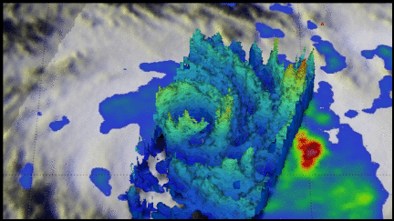
This simulated 3-D flyby around Joalane was made using data from the Ku band on GPM's dual frequency radar. Those radar data discovered that the intense thunderstorms, reaching heights above 16 km (9.9 miles), were located where the heaviest rainfall was measured by GPM's GMI.