
GPM Measures Rain in Cyclone Joalane
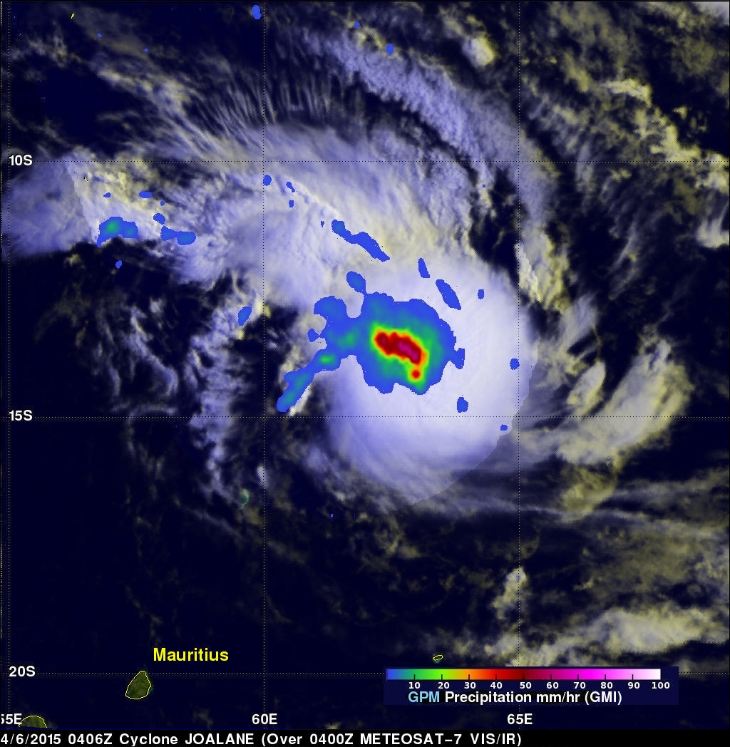
Two powerful tropical cyclones called Ikola and Joalane are now moving through the South Indian Ocean. The GPM core observatory satellite flew over intensifying cyclone Joalane in the South Indian Ocean on April 6, 2015 at 0406 UTC. GPM's Microwave Imager(GMI) found that intense convective thunderstorms within Joalane were dropping rain at a rate of over 63 mm (2.5 inches) per hour.
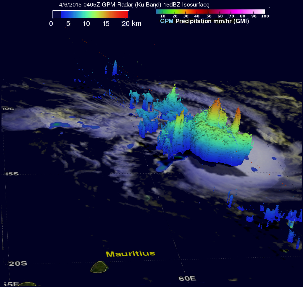
Cyclone Joalane was located northeast of Mauritius at the time of this GPM pass. A 3-D view of Joalane's vertical precipitation structure was constructed from GPM's Radar (Ku Band) data. This cross section shows that several towering thunderstorms near Joalane's center were reaching heights of over 15km (9.3 miles). A few storm tops in a strong rain band south of Joalane's center were found reaching even higher to altitudes of 17.4 km (10.8 miles).
The Joint Typhoon Warning Center predicts that Joalane will move toward the southeast over the open waters of the South Indian Ocean and stay well to east of the islands of Reunion and Mauritius. Joalane is expected to intensify in the next couple days and be category five tropical cyclone on the Saffir-Simpson hurricane wind scale with winds of 140 kts (161 mph).