GPM Views Typhoon Dolphin Headed For Guam
Typhoon Dolphin formed south of Pohnpei in the western Pacific Ocean on May 7, 2015. Dolphin's power has oscillated from a weak tropical depression to typhoon intensity over the past five days. Dolphin is now an intensifying typhoon headed westward.
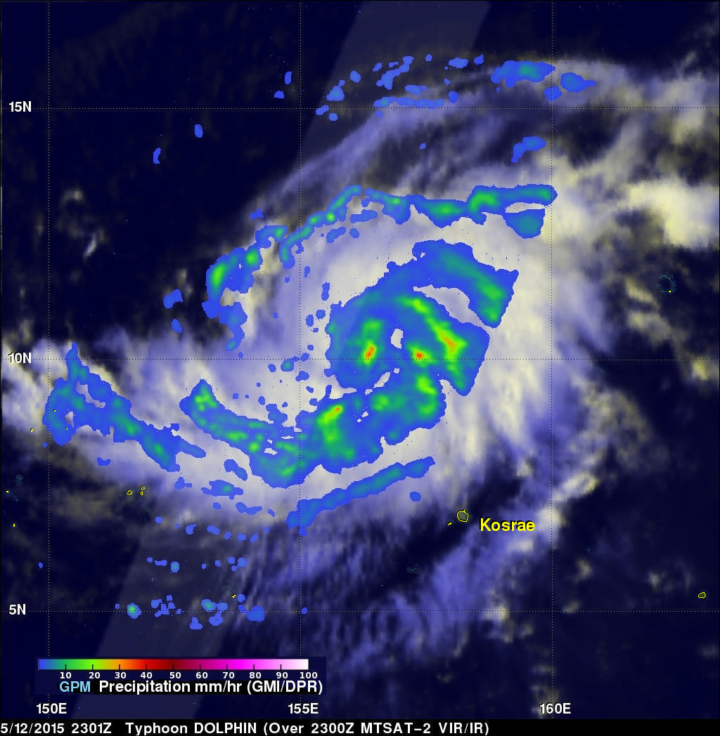
The GPM core observatory satellite flew over Dolphin on May 12, 2015 at 2301 UTC. At that time Dolphin's wind speeds were estimated at about 65 kts (75 mph). Rainfall collected by GPM's Microwave Imager (GMI) showed that rain was falling at a rate of over 47 mm (1.9 inches) per hour in a feeder band to the southeast of Dolphin's eye.
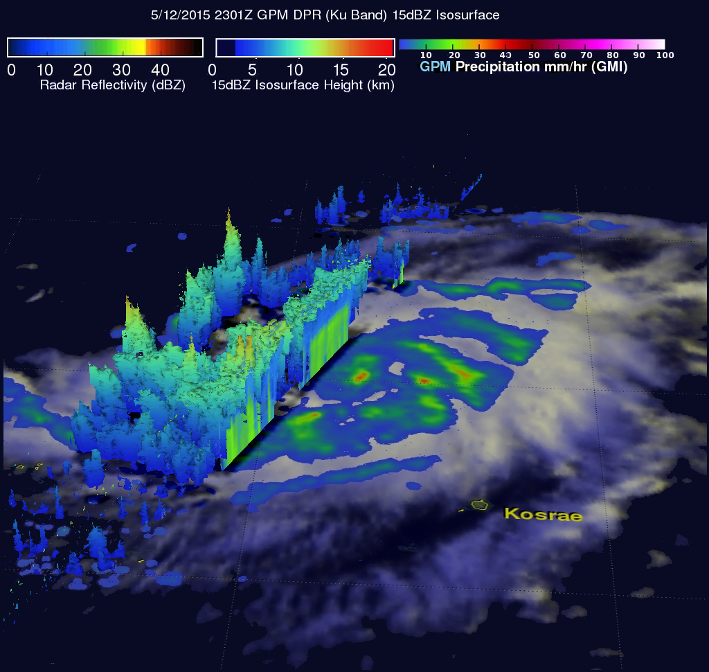
Ku Band data from GPM's Dual-frequency Precipitation Radar (DPR) were used in this image to show the vertical structure of rainfall along the satellite's path. The GPM radar's field of view was of rain bands to the west of Dolphin's eye. Those data show that some storm top heights were reaching heights of above 15 km (9.8 miles) in one intense feeder band that was transporting moisture from the southern side of the typhoon.
The Joint Typhoon Warning Center (JTWC) predicts that typhoon DOLPHIN will become more powerful and will hit Guam in a couple days with sustained winds of about 100 kts (115 mph).


