
Heavy Rain Brings Flooding to Central and Northern Italy
Beginning this past weekend, parts of central and northern Italy received several days of heavy rain as an upper-level trough situated over western Europe down through the Iberian Peninsula in conjunction with a persistent area of low pressure at the surface over the northern coast of Africa brought a steady flow of warm, moist, unstable air northeastward across the country from the western Mediterranean. A stationary frontal boundary draped across the northern third of the Italian Peninsula provided the focus for showers and storms in that part of the country. The rains caused flooding in Venice and four fatalities in the state of Tuscany north of Rome.
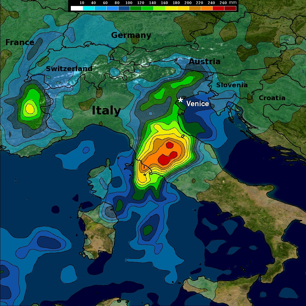
With its combination of passive microwave and active radar sensors, the Tropical Rainfall Measuring Mission satellite (better known as TRMM) is ideally suited to measure rainfall from space. For increased coverage, TRMM can be used to calibrate rainfall estimates from other additional satellites. The TRMM-based, near-real time Multi-satellite Precipitation Analysis (TMPA) at the NASA Goddard Space Flight Center is used to monitor rainfall over a wide portion of the globe. TMPA rainfall totals are shown here for the 7-day period 6 to 13 November 2012 for northern Italy and the surrounding region. TMPA rainfall estimates show upwards of between 160 and 240 mm of rain (~6 to 10 inches, shown in yellow and red, respectively) in a band across north-central Italy. The rains have finally subsided as the upper level system has moved on.
TRMM is a joint mission between NASA and the Japanese space agency JAXA.