
High Level Of Tropical Cyclone Activity South Of The Equator
Tropical cylone activity has recently increased in the the Southern Hemisphere. On March 10, 2014 the TRMM satellite viewed three tropical storms within two hours.
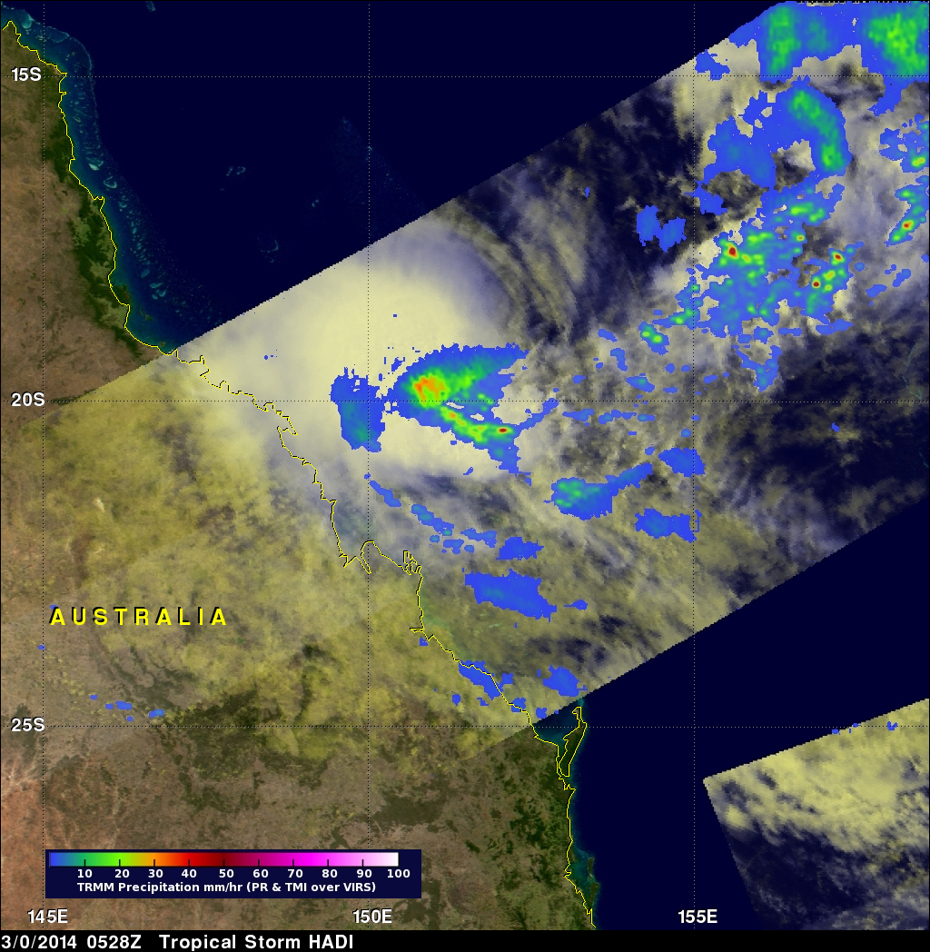
The images above use data received by the TRMM satellite when it flew above tropical storm HADI on March 10, 2014 at 0528 UTC. TRMM found that almost all heavy rainfall with HADI was located in the Coral Sea well off the northeastern coast of Australia. Data from TRMM's Precipitation Radar (PR) instrument were used in the image on the right to show the 3-D structure within the tropical storm.
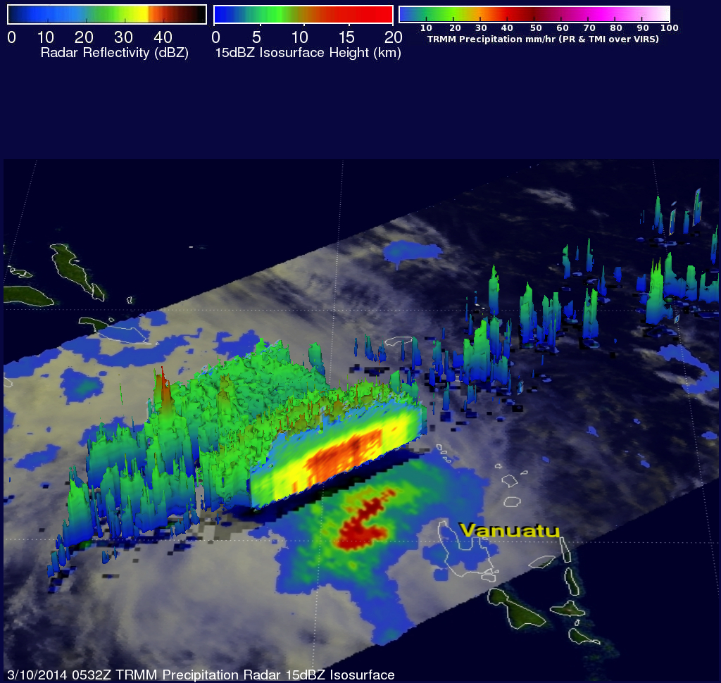
Tropical storm LUSI was located near Vanuatu when TRMM flew over about four minutes later at 0532 UTC. TRMM's Microwave Imager (TMI) and Precipitation Radar (PR) showed that LUSI contained heavy rainfall in a large area northwest of Vanuatu. TRMM's PR data was used in the image on the right to show a 3-D slice through the northwestern side of the tropical storm. TRMM's PR measured rain falling at a rate of over 89 mm/hr (~3.5 inches) northwest of LUSI's center of circulation and TMI revealed that rain was dropping at a rate of over 57mm/hr (~2.2 inches) near LUSI's center.
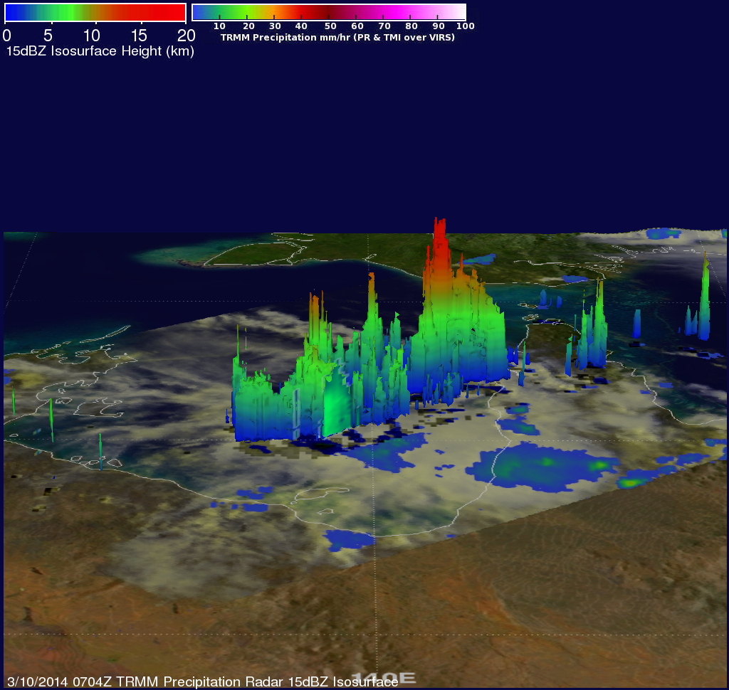
Tropical storm GILLIAN was located in the Gulf Of Carpentaria on March 10, 2014 at 0704 UTC when TRMM flew almost directly over head. TRMM showed that some rainfall from GILLIAN was falling over the York Peninsula but that the most intense rain, falling at a rate of over 72 mm/hr (~2.8 inches), was located in the Gulf Of Carpentaria.
 \
\
The image above uses TRMM's Precipitation Radar (PR) data showing that some of the powerful storms within tropical storm GILLIAN were reaching heights above 16km (~9.9 miles). GILLIAN is predicted to become a slightly more powerful tropical storm in the next three days while moving toward the southwest over the Gulf Of Carpentaria.