Hurricane Ana Bypasses But Soaks Hawaiian Islands
Fortunately for Hawaii hurricane Ana passed to the south of the islands. This meant that for the third time this year the Hawaiian Islands were spared destructive hurricane force winds. However, Ana caused occasionally heavy rain over much of the area and was responsible for flash floods on the the big island (Hawaii).
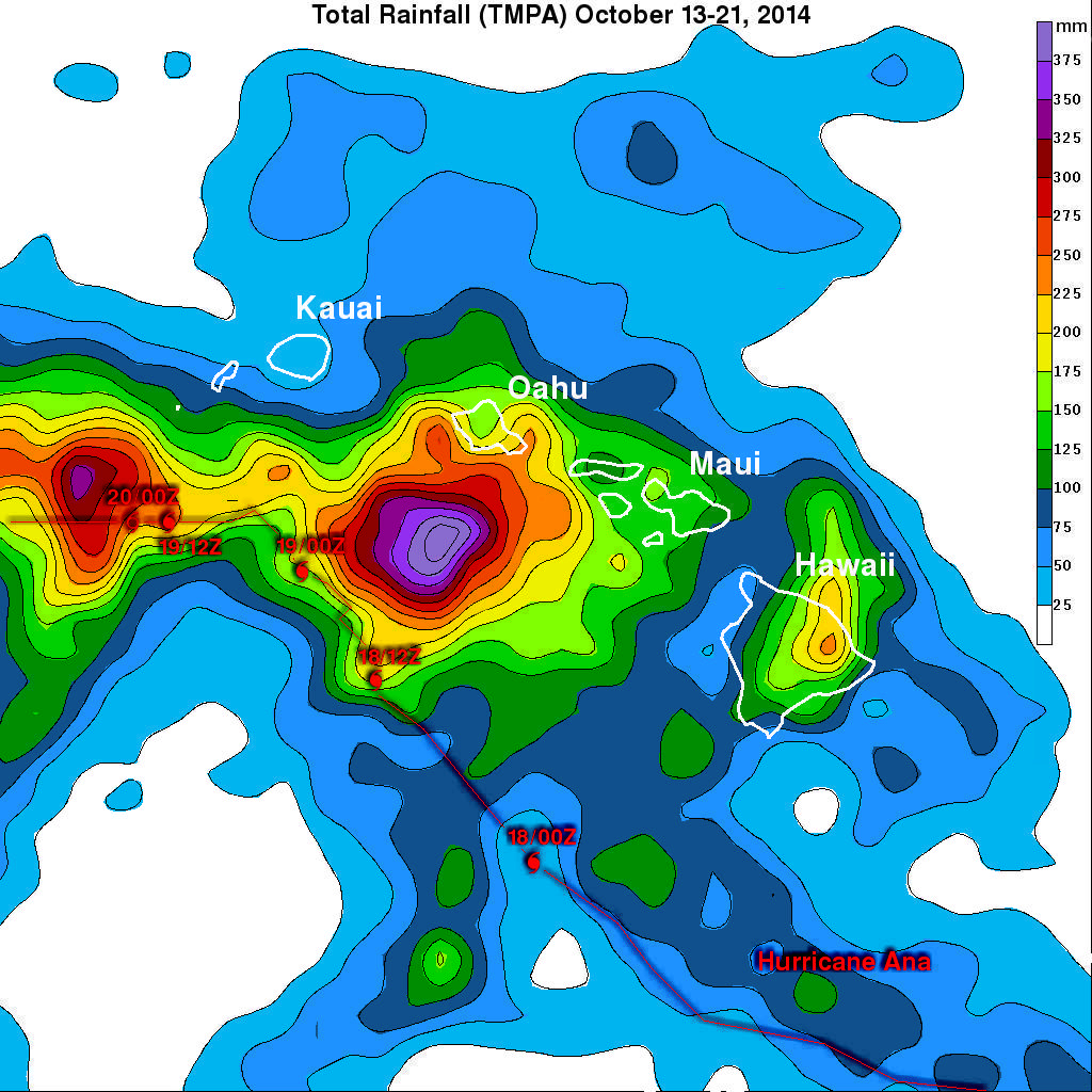
This analysis shows estimated rainfall totals during the period when hurricane Ana formed on October 13, 2014 and moved west of the Hawaiian Islands on October 21, 2014. The TRMM-based, near-real time Multi-satellite Precipitation data (TMPA) analysis is used to monitor rainfall over the global Tropics. A (TMPA) rainfall analysis for the period shows rainfall associated with the passage of Ana. Hurricane and tropical storm symbols at 0000Z and 1200Z show Ana's approximate locations and a line connecting these points shows the estimated path of the hurricane as it moved through the area. The heaviest rainfall totals of greater than 400 mm (~15.7 inches) were measured over open ocean waters south of Oahu. The highest totals over land were analyzed over the eastern slope of the island of Hawaii and over the southeastern side of Oahu where rainfall totals were estimated to be greater than 225 mm (~8.9 inches).


