
Hurricane Barbara Comes Ashore in Southern Mexico
_0.jpg)
Hurricane Barbara recently made landfall along the southern Pacific coast of Mexico. According to the National Hurricane Center (NHC), the center of the storm came ashore around 19:50 UTC (12:50 pm PDT) Wednesday May 29th about 35 km (~20 miles) west of Tonala, Mexico as a minimal Category 1 hurricane with maximum sustained winds of 75 mph.
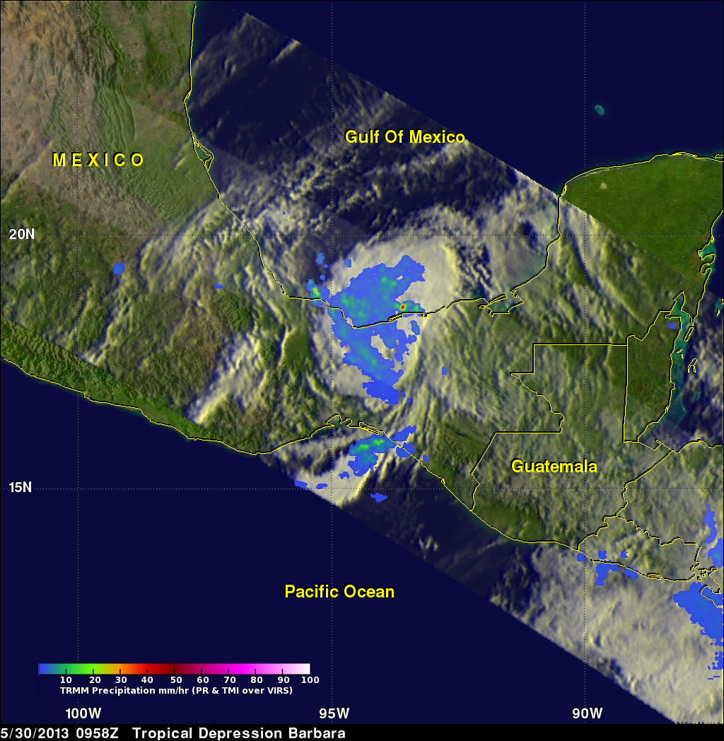
TRMM captured the first image of Barbara several hours after it made landfall. The image was taken at 6:46 pm PDT 29 May (01:46 UTC 30 May) 2013 and shows the horizontal distribution of rain intensity within the storm. Rain rates in the center of the swath are from the TRMM Precipitation Radar (PR), and those in the outer swath are from the TRMM Microwave Imager (TMI). The rain rates are overlaid on infrared (IR) data from the TRMM Visible Infrared Scanner (VIRS). As is typical, after making landfall Barbara began to weaken and was a tropical storm with winds reported at 60 mph at the time of this image. The image from TRMM shows no evidence of an eye and areas of mostly light (blue) to moderate (green) rain within the storm. Localized areas of heavier rain are evident inland northwest of the center and along the coast where the storm's circulation is drawing moist air ashore. After making landfall, Barbara continued in a mostly northward direction across southern Mexico and began to emerge over the southern Gulf of Mexico. The next image was taken by TRMM at 09:58 UTC (2:58 am PDT) on the 30th of May. By this time, Barbara had been downgraded to a tropical depression by NHC with maximum sustained winds of 30 knots (~35 mph). Most of the rain associated with Barbara at this time appears to be light (blue areas) with a smaller proportion of moderate rain (green areas) than before and only an isolated area of heavy rain along the Gulf coast side (red dot).
Select a Quicktime animation or Mpeg animation that illustrates how Barbara changed between these two TRMM orbits.
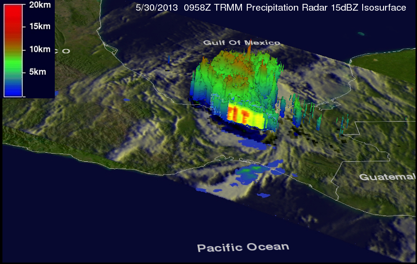
The last image was taken at the same time as the second and shows a 3D perspective of Barbara courtesy of the TRMM PR. Most of the echo tops are low to moderate (green and orange areas) with the exception of the one taller tower (red top) that reaches up to around 12 km. This convective tower is associated with the area of heavy rain shown in the previous image.
In order for the storm to regenerate or maintain itself, new areas of convection like this would have to occur near the center. Barbara, however, is expected to remain near the coast under the influence of land and dissipate with the main threat being inland flooding. So far two person were reported to have died in the storm. The East Pacific hurricane season officially begins on May 15 and runs through November 30.
Click here to see a Quicktime simulated Flyby animation courtesy of TRMM PR.
Click here to see a Mpeg simulated Flyby animation courtesy of TRMM PR.