
Hurricane Bud Threatens Western Mexico's Coast
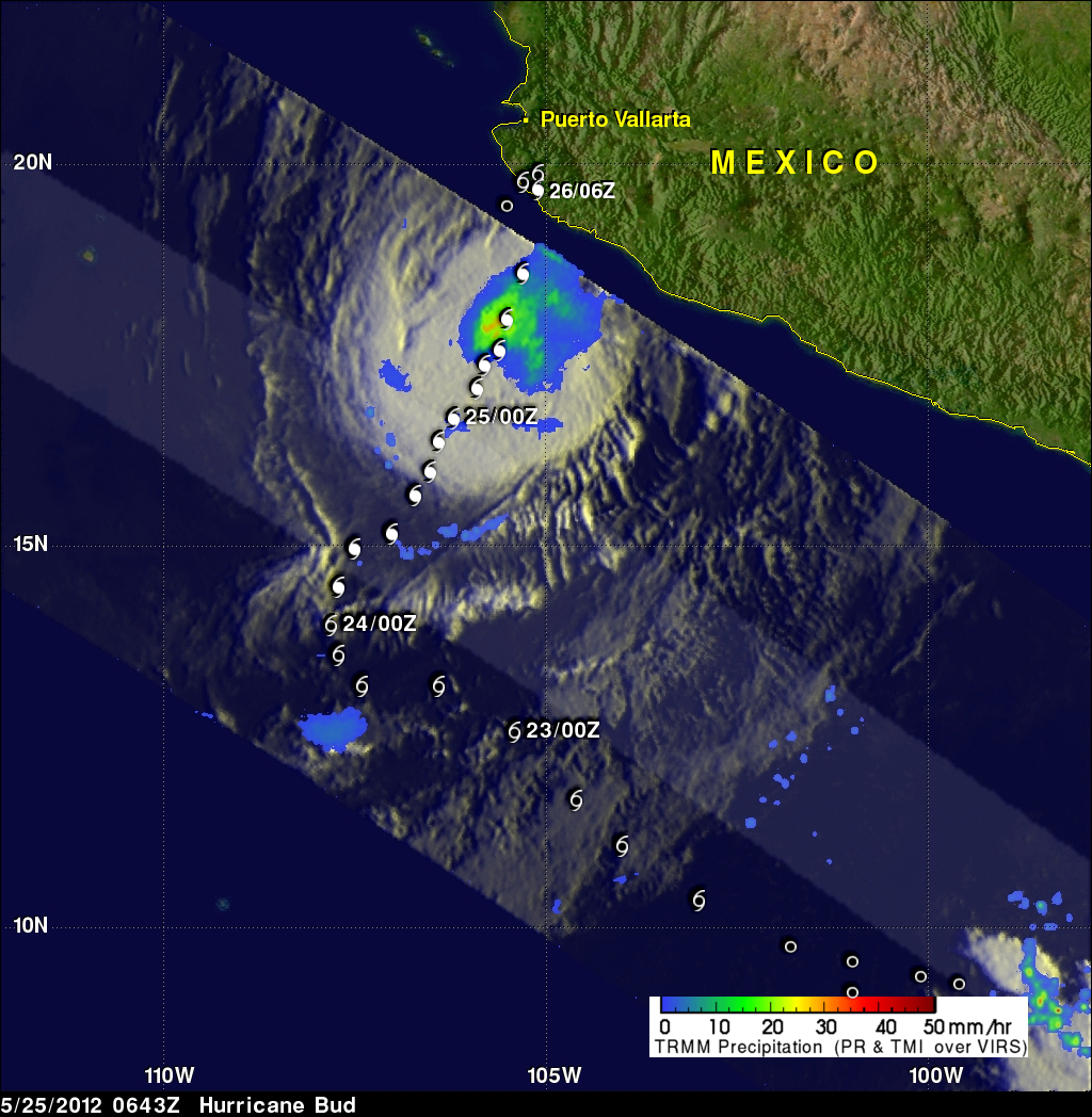
The TRMM satellite passed above hurricane Bud early this morning at 0429 UTC (9:30 PM PDT May 24, 2012). A large area of moderate to heavy rainfall with rates of over 30mm/hr (~1.2 inches) was revealed in Bud by TRMM's Microwave Imager (TMI) instrument. The rainfall analysis was overlaid on an enhanced infrared image derived from TRMM's Visible and InfraRed Scanner (VIRS). Bud's past and predicted locations are shown overlaid in white. Heavy rainfall from hurricane Bud's slow movement may result in severe flooding and dangerous landslides as it moves over Mexico's rugged coastal terrain.