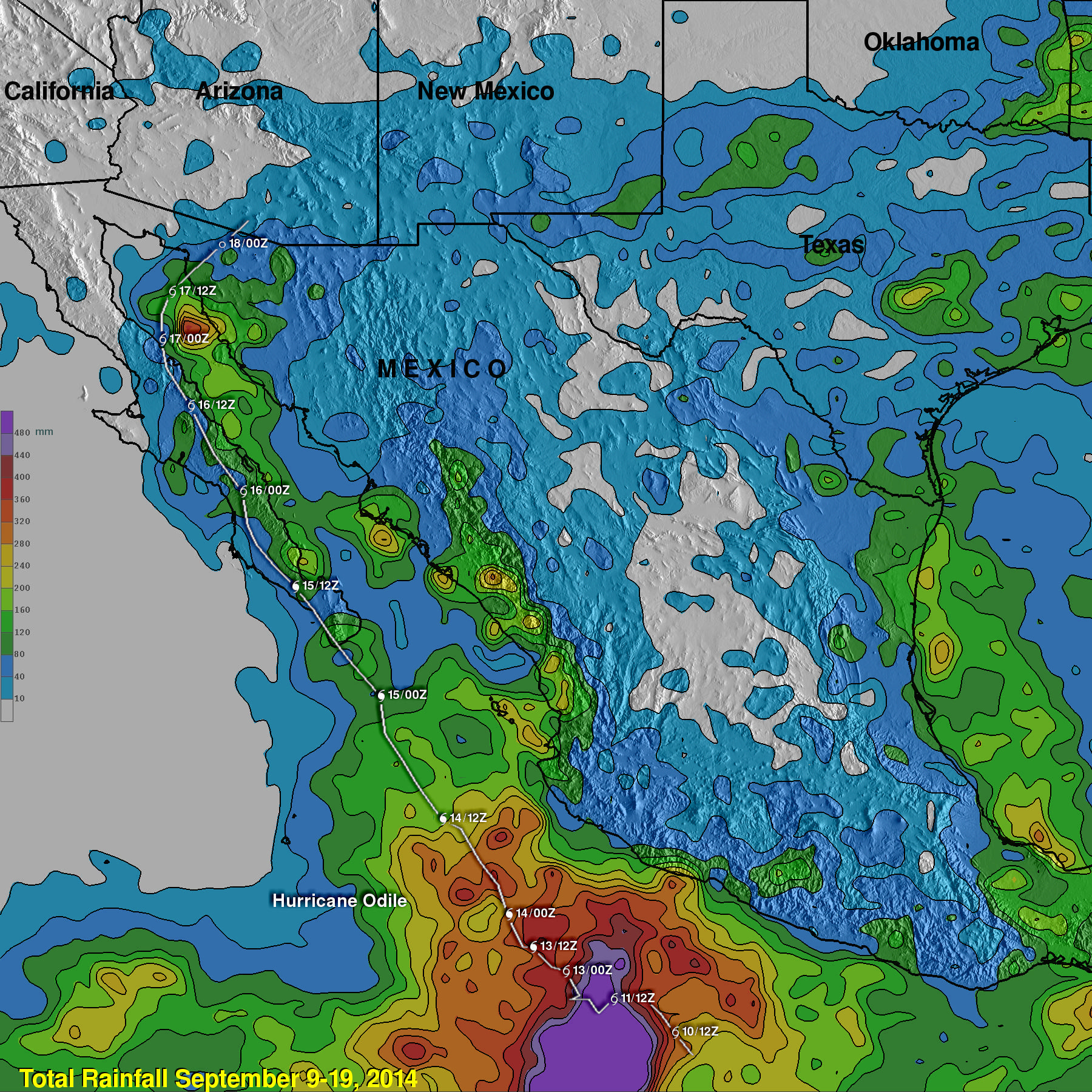
Hurricane Odile Rainfall Totals
During the past week hurricane Odile and remnants have produced heavy rainfall that caused dangerous flooding over the Baja California peninsula and the southwestern United States. Rainfall from Odile may be welcomed in the Southwest where some areas have been experiencing extreme to exceptional drought conditions.
The Tropical Rainfall Measuring Mission or TRMM satellite was launched in November 1997 with the primary mission of measuring rainfall in the Tropics using a combination of passive microwave and active radar sensors. The rainfall analysis above was made using real-time TRMM Multi-Satellite Precipitation Analysis (TMPA) data produced at the NASA Goddard Space Flight Center. Those data are used to monitor rainfall over the global Tropics. TMPA rainfall totals are shown here from 9-19 September, 2014 during the period when Hurricane Odile formed over the eastern Pacific Ocean southwest of Mexico, hit Baja California and when the dissipating tropical cyclone was spreading rainfall over the southwestern United States. Odile's approximate locations at 0000Z and 1200Z daily are shown overlaid in white. The heaviest rainfall during this period was found in the ocean off southwestern Mexico where Odile and other tropical cyclones have recently formed. Rainfall totals there of up to 840 mm (33 inches) are shown in purple. Rainfall totals above 320 mm (12.5 inches) were analyzed near Odile's path along the Baja California peninsula. This analysis indicates that in the southwestern United States Odile's remnants produced the highest rainfall totals of over 160 mm (6.3 inches) in northwestern Texas.


