Hurricane Odile Strikes Baja California
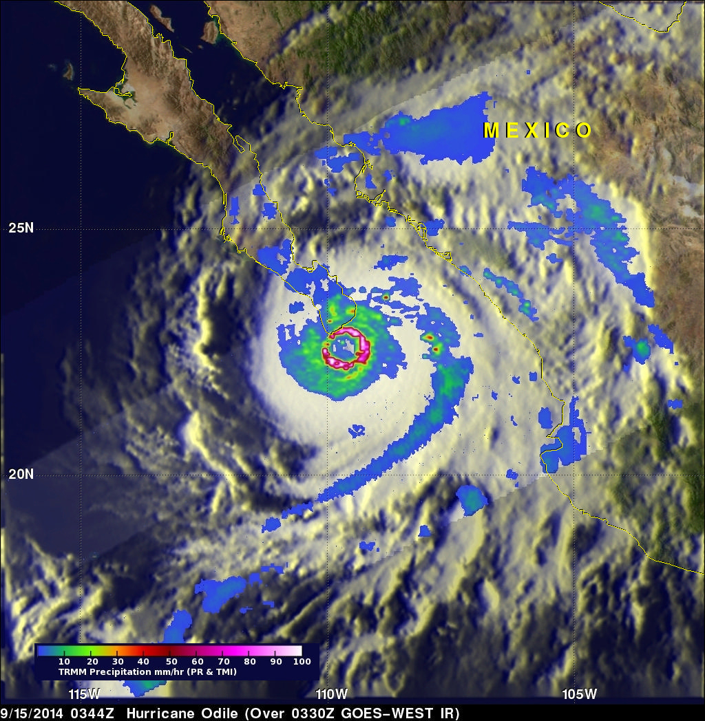
The TRMM satellite passed directly above hurricane Odile on September 15, 2014 at 0344 UTC. This was about an hour before the strong Hurricane hit Baja California near Cabo San Lucas at around 0445 UTC (September 14, 2014 9:45 PM PDT). The National Hurricane Center (NHC) hurricane discussion on September 15, 2014 said, "The estimated intensity of 110 kt at landfall ties Odile with Olivia (1967) as the strongest hurricane to make landfall in the satellite era in the state of Baja California Sur". The image above shows rainfall derived from TRMM's Precipitation Radar (PR) and Microwave Imager (TMI) instruments overlaid on a GOES-WEST enhanced Infrared image received at 0330 UTC. TRMM PR showed that Odile contained intense thunderstorms dropping rain at a rate of over 188.4 mm ( about 7.4 inches) per hour in the hurricane's nearly circular eye wall.
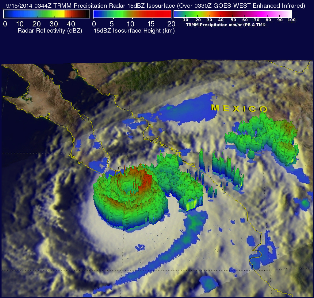
One of the TRMM satellites most useful features has been its ability to provide vertical profiles of the rain and snow from the surface up to a height of about 12 miles (20 kilometers). The image above shows a simulated 3-D view of hurricane Odile's rainfall structure using the satellite's radar reflectivity data. This view shows that the tops of many intense thunderstorms in Odile's eye wall were reaching heights above 12.5 km(about 7.8 miles).
Hurricane Odile's wind speeds decreased to about 100kts (115 mph) after hitting land and winds are forecast by the NHC to slowly decrease to below hurricane force tomorrow. Torrential rainfall is predicted to continue near the weakening system. Flash floods and landslides with rainfall totals of over 152-305 mm (6-12 inches) are predicted by the NHC as Odile travels over the Baja California Peninsula.


