
Hurricane Raymond Soaking Mexican Coast

A month ago hurricane Manuel caused caused landslides and extensive flooding along Mexico's Pacific Ocean coast. Recently formed hurricane Raymond is expected to cause heavy rainfall in nearly the same area.
The TRMM satellite flew directly above hurricane Raymond on October 21, 2013 at 0111 UTC (October 20 at 6:11 PM PDT). TRMM Precipitation Radar (PR) data from that orbit shows that hurricane Raymond contained towering thunderstorms on the western side of the eye wall that were reaching to heights above 15km (~9.3 miles).
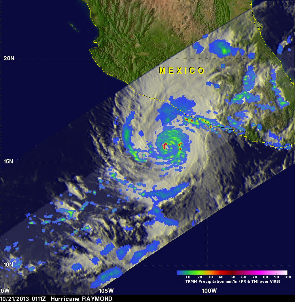
TRMM PR also recorded precipitation in Raymonds eye wall that was falling at a rate of over 153mm/hr (~5.6 inches) and returning radar reflectivity values greater than 53dBZ to the satellite. Rain was shown by TRMM to be falling at a rate of over 30mm/hr (~1.2 inches) along Mexico's coast.
Powerful hurricane Raymond is predicted by the National Hurricane Center (NHC) to produce life threatening flash floods and mud-slides over south-central Mexico. Raymond is then forecast to start moving toward the west-southwest away from Mexico on Wednesday October 23.