
Hurricane Raymond's Copious Rainfall Analyzed
Powerful hurricane Raymond, located off Mexico's south-central Pacific coast, has weakened to a tropical storm. It has now started to move slowly away from the location where it has been parked since Monday October 21, 2013. Raymond dropped abundant rainfall in much of the same area already hit by deadly flooding and landslides with Hurricane Manuel last month.
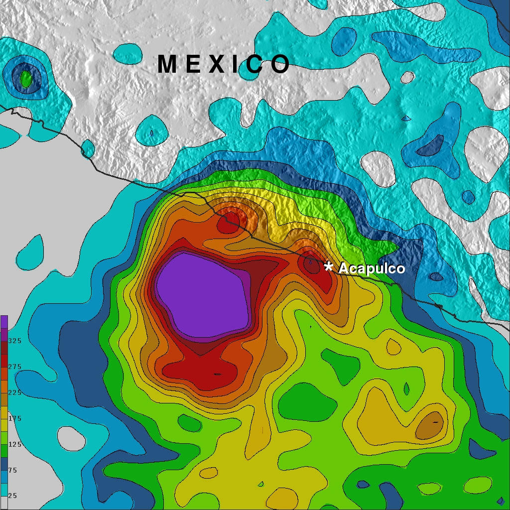
The rainfall analysis above was made at Goddard Space Flight Center using TRMM-based, near-real time Multi-satellite Precipitation data (TMPA) collected during the period from October 15 to 23, 2013. Rainfall totals greater than 125mm (~4.9 inches) occurred in the coastal area northeast of Raymond. The analysis also indicates that rainfall totals were greater than 350mm (~13.8 inches) along the coast northwest of Acapulco. During the past week extreme rainfall amounts of over 560mm (~22 inches) fell in the open waters of the Pacific where Raymond was stalled.