
Intensifying TD02 Moves Into The Bay Of Campeche
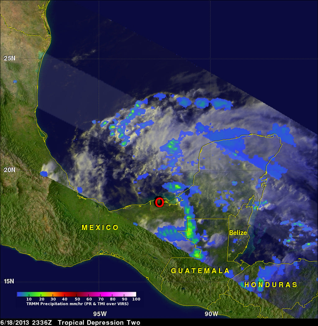
The TRMM satellite passed above tropical depression two on June 18, 2013 at 2336 UTC (6:43 PM CDT). A red circle shows the approximate location of TD02 just before it entered the Bay Of Campeche in the the southern Gulf Of Mexico. Data from TRMM's Microwave Imager (TMI) and Precipitation Radar (PR) instruments showed that TD02 was still only producing light to moderate rainfall. The most intense rainfall over land, at about 28.7mm/hr (~1.1 inches), was found by TRMM's TMI in a line of storms extending from northwestern Guatemala into the Gulf Of Mexico.
The National Hurricane Center (NHC) predicts that TD02 will become tropical storm Barry very soon as it's center moves over the Bay of Campeche. Significant flooding is predicted in Mexico's state of Veracruz.