
Intensifying Typhoon Guchol Viewed By TRMM
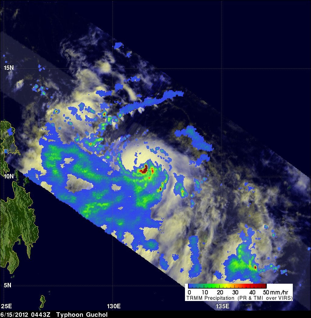
Typhoon Guchol in the western Pacific Ocean is becoming increasingly more powerful and was seen by the TRMM satellite on Friday June 15, 2012 at 0443 UTC. The center of the intensifying typhoon was covered very well by TRMM's Precipitation Radar (PR) data. TRMM PR showed that very heavy rainfall was occurring in the eastern side of Guchol's eye wall.
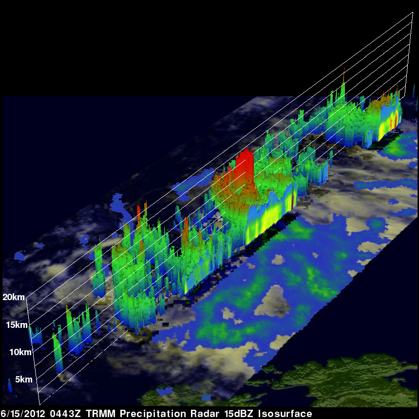
This 3-D image (looking toward the east) from TRMM PR data reveals that towering storms in the eastern side of Guchol's eye were reaching the amazing height of almost 17km (~10.56 miles). Intense rainfall in Guchol's eye wall was returning values greater than 54 dBZ to the TRMM satellite. Click here to take a simulated flight to examine the 3-D structure in the center of the PR image above.
Typhoon Guchol is forecast by the Joint Typhoon Warning Center (JTWC) to reach category four strength on the Saffir-Simpson scale on June 17, 2012 with wind speeds of 115kts (~132 mph). A couple days later Guchol is expected to strike Japan's main island of Honshu as a weaker category one typhoon with wind speeds of about 70kts (~81 mph).