
Monsoon Trough Continues to Drench Northeastern Australia
Low pressure centers associated with a summer monsoon trough have repeatedly drenched Australia from central Queensland to northern New South Wales. The clockwise rotation of these low pressure centers have continued to pump warm moist air from the Coral Sea over these areas resulting in severe flooding. Thousands of Australians have been displaced by this flooding. The current La Nina conditions are predicted to continue causing heavy rainfall over northeastern Australia.
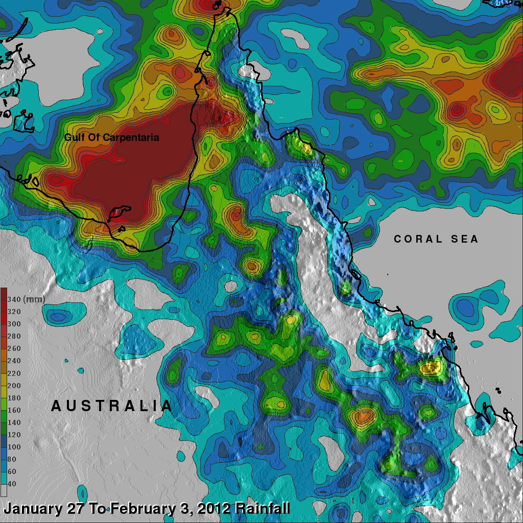
Data from the TRMM satellite are used to calibrate rainfall data merged from various satellite sources. This TRMM-based, near-real time Multi-satellite Precipitation Analysis (TMPA) at the NASA Goddard Space Flight Center is used to monitor rainfall over the global Tropics. TMPA rainfall amounts in the state of Queensland are shown above for the week of January 27 to February 3, 2012. The highest amounts of extreme rainfall (shown in dark red), totalling more than 340 mm (~ 13 inches), extend from the Gulf of Carpentaria over the Cape York Peninsula.