
More Flooding Rainfall In Madagascar
A weak tropical cyclone locally called Irina caused flooding over northern Madagascar less than two weeks after deadly flooding by Tropical Cyclone Giovanna . The lastest tropical cyclone didn't have very strong winds when it passed over the coastal city of Vohemar on Madagascar's northeastern coast but street flooding was reported.
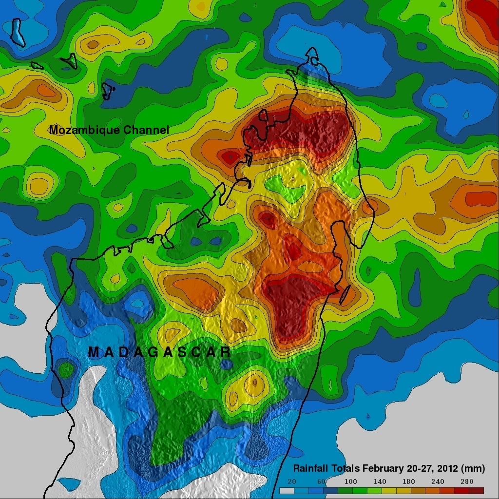
The rainfall analysis above was made at the Goddard Space Flight Center using data from a near-real time Multi-satellite Precipitation Analysis (TMPA). TRMM-based near-real time Multi-satellite Precipitation Analysis (TMPA) data are used to monitor rainfall over the global Tropics. This analysis shows that during the past week the tropical cyclone contributed to flooding rainfall totaling over 280mm (~11 inches).
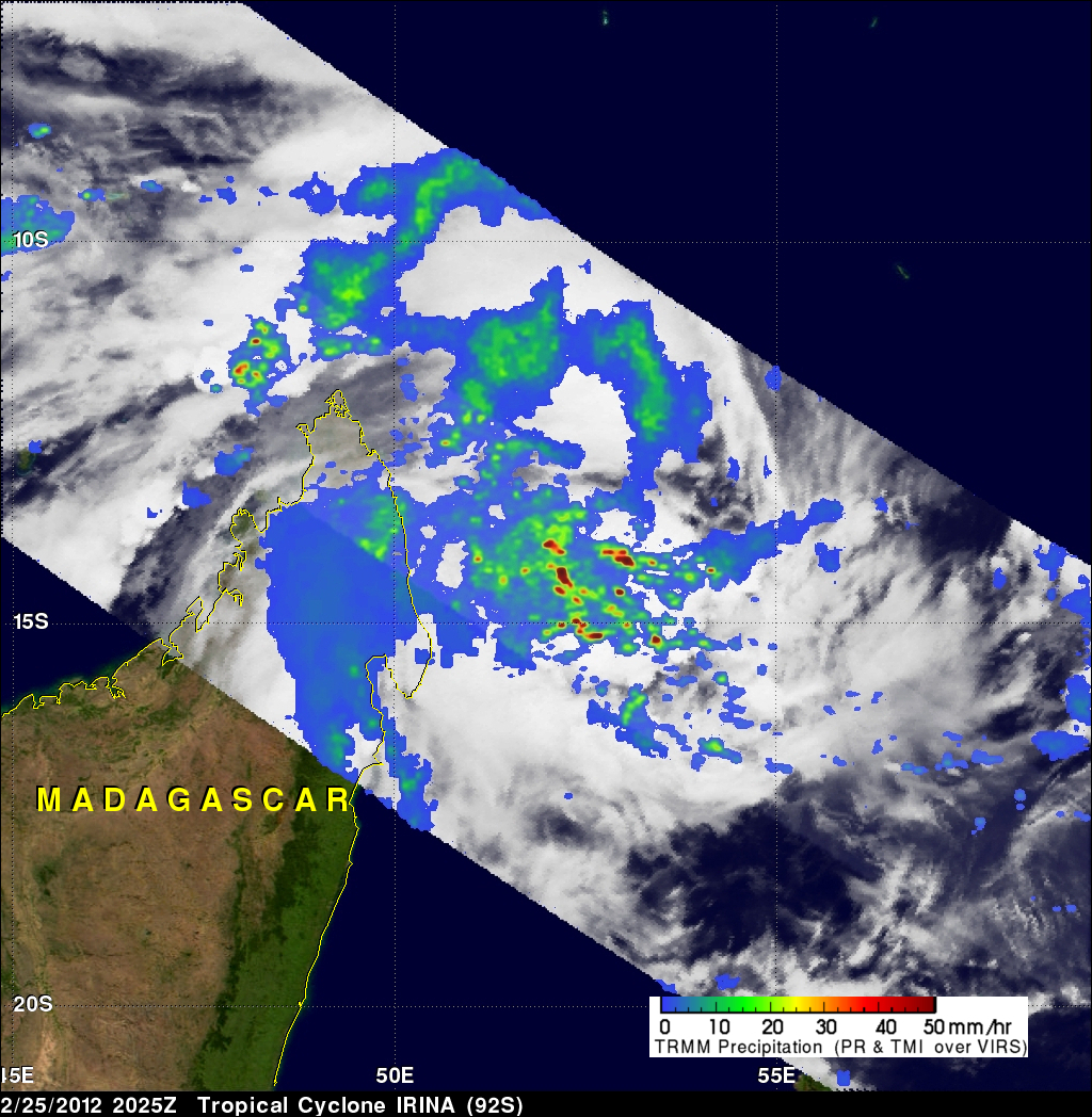
The TRMM satellite passed over this area on February 25, 2012 at 2025 UTC before this stormy area moved over northeastern Madagascar. Rainfall derived from TRMM's Microwave Imager (TMI) and Precipitation Radar (PR) instruments shows that numerous intense storms were dropping rainfall at a rate of over 50mm/hr (~2 inches). TRMM Precipitation Radar data also showed that some powerful storms within the area reached to heights of over 15km (~9.3 mile).