
Morning View of Tropical Storm Melissa
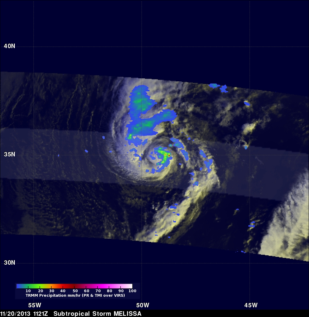
The TRMM satellite passed directly above tropical storm Melissa's center of circulation on November 20, 2013 at 1121 UTC (6:21 EST). TRMM's Precipitation Radar (PR) instrument found that rain was falling at a maximum rate of 55 mm/hr (~2.2 inches) in an area just to the southeast of Melissa's center of circulation.
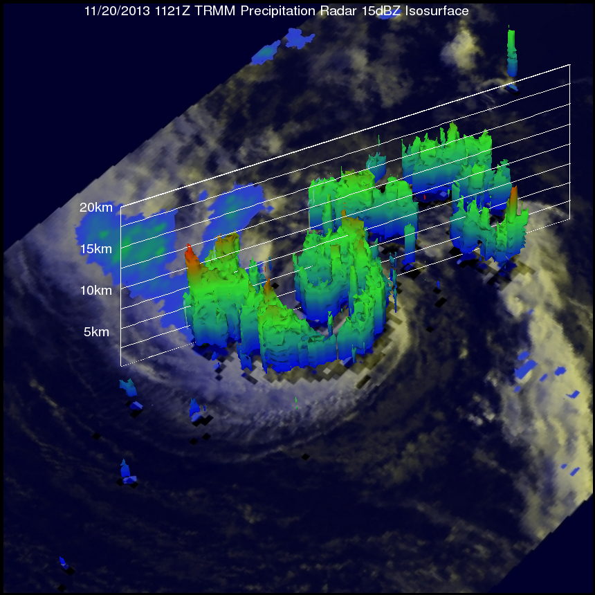
TRMM Precipitation Radar data were also used in the image on the right to show Melissa's 3-D structure. The tallest towers, reaching heights of over 13km (~8 km), were located in a band of rainfall to the northwest of Melissa's center. The strongest intensity radar echo of over 49dBZ was returned from an area of heavy convective storms near Melissa's center. This heavy convection near the center signaled Melissa's transition from a subtropical storm to a tropical storm.
The National Hurricane Center (NHC) predicts that tropical storm Melissa will maintain about the same intensity for the next 36 hours while moving toward the northeast over the open waters of the Atlantic Ocean.
Click here to see a Low Resolution 640x360 simulated 3-D (Quicktime) flyby animation over subtropical storm Melissa using TRMM PR data.