
NASA's TRMM Satellite Sees Tornadic Texas Storms in 3-D
NASA's Tropical Rainfall Measuring Mission (TRMM) satellite provides a look at thunderstorms in three dimensions and shows scientists the heights of the thunderclouds and the rainfall rates coming from them, both of which indicate severity. Powerful thunderstorms that created severe weather were more than 8 miles high.

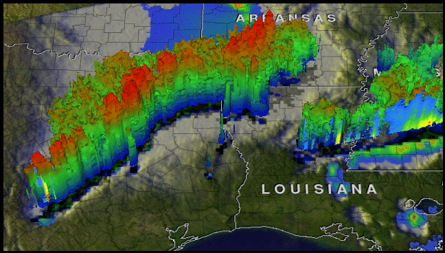
The TRMM satellite passed above northeastern Texas on April 3, 8:33 p.m. CDT and gathered rainfall and cloud height data from a line of thunderstorms moving through the area. The rainfall image above shows a distinct line of tornadic thunderstorms extending from Arkansas through central Texas, where heavy rain was falling along a line at over 2 inches (50 mm) per hour (in red).
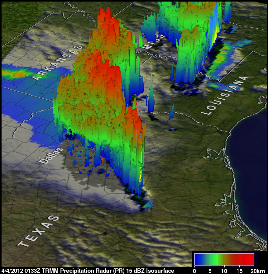
TRMM's Precipitation Radar (PR) data gathered above northeastern Texas on April 3, 8:33 p.m. CDT were used to provide a 3-D view of the intensity and vertical distribution of precipitation. PR data showed that some of the powerful storms within this area were pushing up to heights above about 8 miles (13 km).
NOAA's National Weather Service Storm Prediction Center received 18 reports of tornadoes occurring on April 3 over northeastern Texas. Some of these very destructive storms dropped softball sized hail as they passed to the south of the Dallas/Fort Worth area.
The above image shows a simulated 3D flyby from the TRMM satellite around these storms.
TRMM is a joint mission between NASA and the Japanese Space Agency, JAXA. NASA and JAXA are currently collaborating on the follow-on mission called the Global Precipitation Measurement (GPM) mission. The GPM mission will provide a new generation of satellite observations of rain and snow worldwide every three hours for scientific research and societal benefits.