Ophelia Reviving and Philippe Weakening
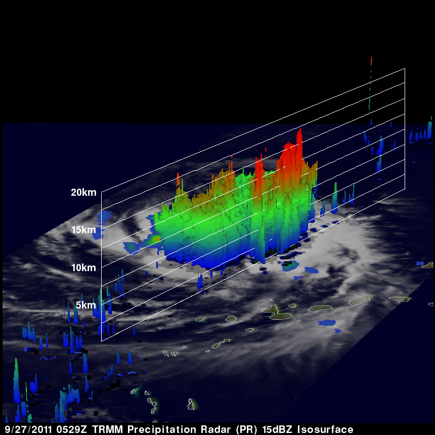
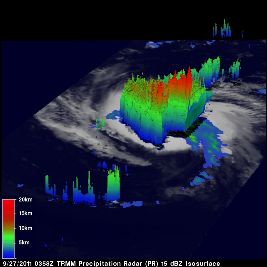
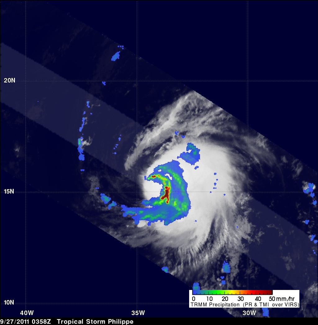
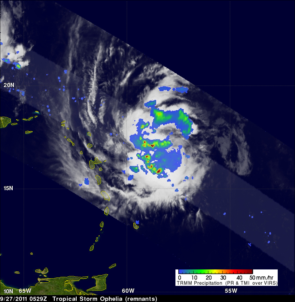
The TRMM satellite passed above two tropical cyclones in the Atlantic Ocean early today. Tropical storm Philippe was seen at 0358 UTC (12:58 PM EDT 26 September 2011) and the regenerating remnants of tropical storm Ophelia were observed at 0529 UTC ( 1:29 AM EDT). TRMM's Precipitation Radar (PR) data were used in these images above to show the vertical structure of both storms.
The image above used PR data to show that powerful thunderstorm towers were reaching to heights of over 15km (~9.3 miles) in the center of the increasingly better organized Ophelia remnants.
Tropical storm Philippe on the other hand (below) shows the effects of wind shear that exposed the western side of the storm with convective thunderstorm towers only remaining on the eastern side of the storm. Tropical Storm Philippe has been predicted to travel harmlessly toward the northwest over the open waters of the eastern Atlantic Ocean. Ophelia's regenerating remnants were located a couple hundred miles east-northeast of the northern Leeward Islands.