
Persistant, Heavy Rains lead to Flooding in Haiti
A trough of low pressure draped across the Greater Antilles together with a persistent area of broad low pressure located in the western Caribbean combined to bring a weeks worth of steady and often heavy rains to the region. This resulted in flooding across portions of Haiti, Jamaica, the Dominican Republic, Puerto Rico, and the Virgin Islands.
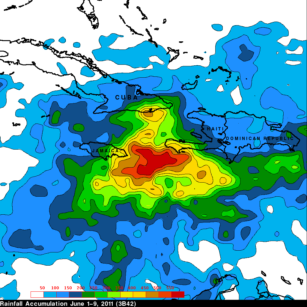
The Tropical Rainfall Measuring Mission satellite, which was launched in November of 1997 uses both passive and active sensors to measure rainfall over the global tropics from space. To increase the effective coverage, TRMM can be used to calibrate rainfall estimates from other satellites. The TRMM-based, near-real time Multi-satellite Precipitation Analysis (TMPA) at the NASA Goddard Space Flight Center provides quantitative rainfall estimates over the global tropics. TMPA rainfall totals for the period 1-8 June 2011 are shown for the north-central Caribbean. The heaviest rainfall totals (shown in red) exceed 550 mm (~22 inches) and occur offshore between the southwestern tip of Haiti and Jamaica. Over land, the highest rainfall totals, on the order of 350 to 450 mm (~14 to 18 inches, shown in yellow), are over the southwestern tip of Haiti, eastern Jamaica, and the southeastern coast of Cuba. Haiti, which is well-known for being vulnerable to flash floods due to its steep topography and exposed hillsides, suffered the greatest casualties, with 25 people reported dead as a result of flooding and mudslides. Most of the fatalities were in and around the capitol of Port-au-Prince. The Dominican Republic, meanwhile, reported 5 fatalities as a result of the flooding.
Image produced by Hal Pierce (SSAI/NASA GSFC) and caption by Steve Lang (SSAI/NASA GSFC)