Potential Tropical Development Southeast Of Hawaii

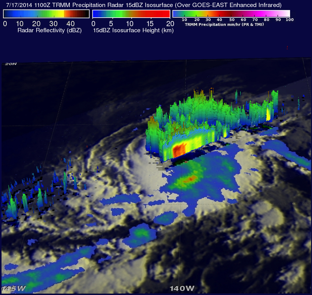
Early this morning at 1100 UTC the TRMM satellite flew above an area where a possible tropical cyclone is developing southeast of the Hawaiian Islands (12 North 140 West). A rainfall analysis from TRMM's Microwave Imager (TMI) and Precipitation Radar (PR) instruments is shown on the left overlaid on a GOES-WEST image received at the exact same time. TRMM PR data found powerful storms near the center of the tropical disturbance where rain was falling at a rate of over 105 mm (about 4.1 inches). Radar reflectivity values of over 50dBZ were being returned to the satellite from intense rain showers in the same stormy area.