
Powerful Rusty At Australia's Door
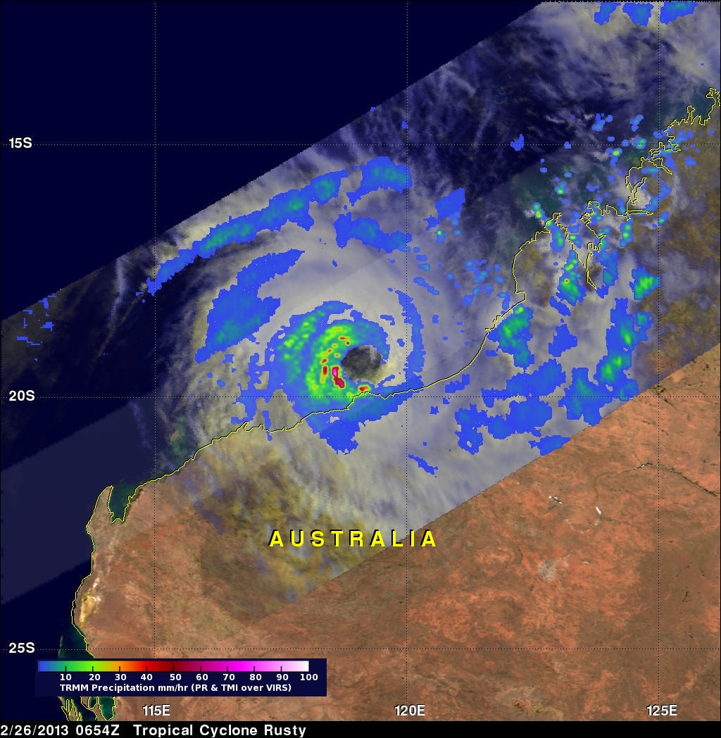
Tropical cyclone Rusty's winds had increased to hurricane intensity when the TRMM satellite flew directly above on February 26, 2013 at 0654 UTC. A rainfall analysis derived from TRMM data is shown with the first image. Rain rates in the center of the swath are from the TRMM PR, while those in the outer swath are from the TRMM Microwave Imager (TMI). The rain rates are overlaid on a combination infrared (IR) visible (vis) image derived from the TRMM Visible Infrared Scanner (VIRS). TRMM PR found that the heaviest surface rain was coming down at a rate of over 138mm/hr (~5.4 inches). This intense band of rainfall was located within strong thunderstorms located in Rusty's western eye wall.
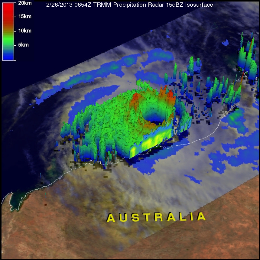
A 3-D image derived from TRMM's Precipitation Radar (PR) data shows that the tops of some towering thunderstorms in Rusty's eye wall were reaching heights of over 12km (~7.5 miles). Click here to see a simulated flight above Rusty courtesy of TRMM PR.