
Powerful Tropical Cyclone Ita Hits Australia
As predicted, powerful tropical cyclone ITA hit the Queensland coast of northeastern Australia late Friday (local time). At that point ITA was a category four on the Saffir-Simpson hurricane intensity scale with winds estimated at over 120 kts (about 138 mph) . This intensity was down slightly from ITA's estimated peak sustained wind speed of 135kts (about 155 mph) when the dangerous tropical cyclone was approaching Australia.
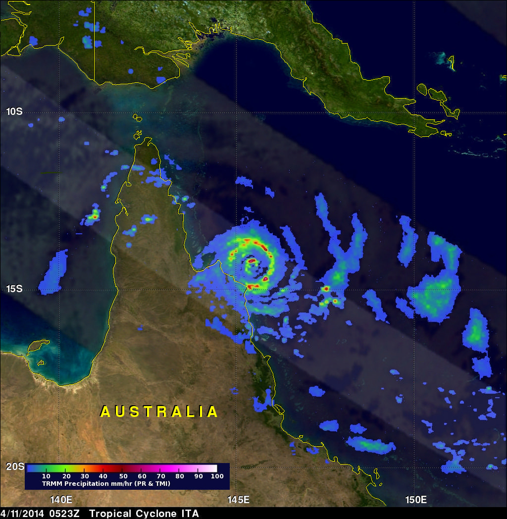
The TRMM satellite passed almost directly above as tropical cyclone ITA was approaching the Queensland coast on April 11, 2014 at 0523 UTC. At the time of this TRMM view ITA had winds estimated at about 125kts (about 144 mph). Rainfall data from TRMM's Microwave Imager (TMI) and Precipitation Radar (PR) instruments are shown on this image. TRMM PR measured rain falling at a rate of over 91 mm/hr (about 3.6 inches) around ITA's eye.
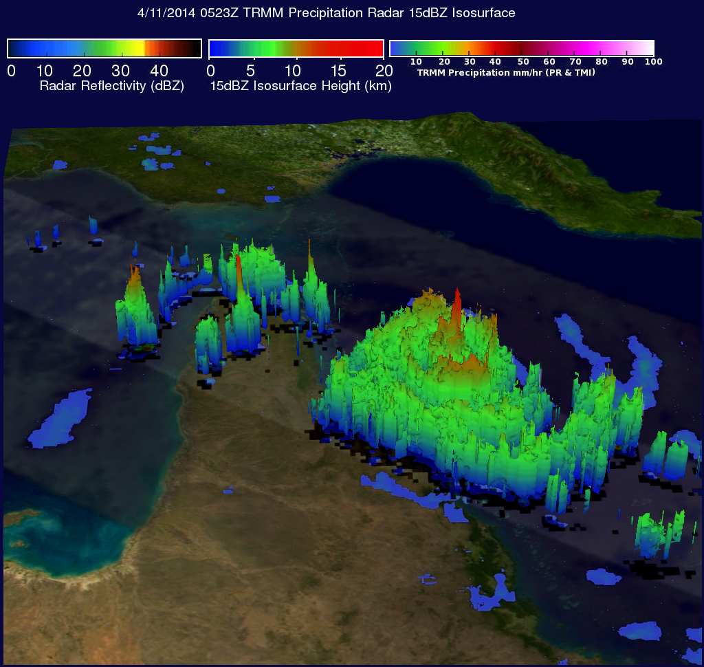
Data from TRMM's Precipitation Radar (PR) instrument was again used to reveal the 3-D vertical structure of rainfall within tropical cyclone ITA. One towering thunderstorm in ITA's eye wall was found by TRMM PR to be reaching an altitude of over 13km (~8 miles) and returning radar reflectivity values of almost 52dBZ to the satellite.
Tropical cyclone ITA is predicted by the Joint Typhoon Warning Center (JTWC) to maintain hurricane intensity today as it moves south-southeastward traveling close to Cairns along Australia's Queensland coast. ITA's intensity is predicted to decrease to tropical storm strength as it moves back into the Coral Sea in a few days.
Click here to see a Low Resolution 640x360 simulated 3-D (Quicktime) flyby animation using TRMM PR data.
Click here to see a Low Resolution 640x360 simulated 3-D (MPEG) flyby animation using TRMM PR data.