Recent Flooding in the Midwest, 5 Year Anniversary of 2008 Flood
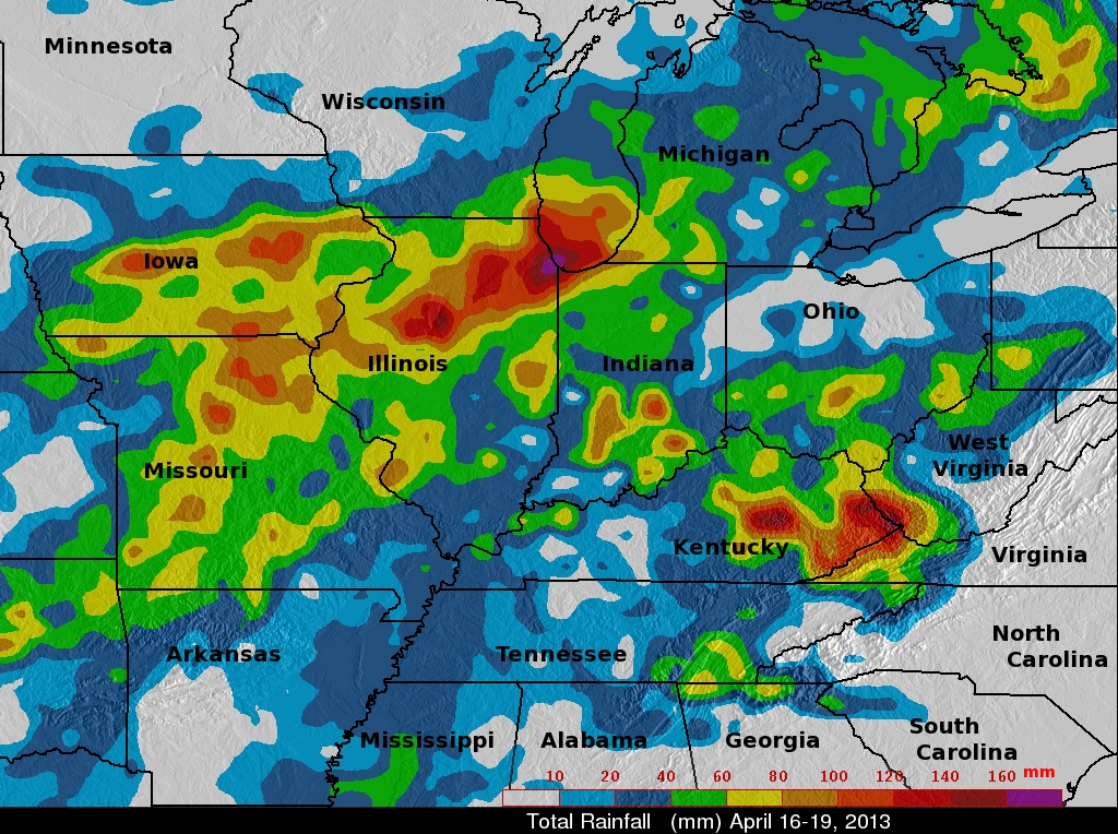
An advancing frontal system extending from the Great Lakes region all the way down to the Gulf Coast supported a line of widespread storms and thunderstorms that brought heavy rain to parts of Iowa, Illinois, Missouri, and Indiana. The hardest hit area was northern Illinois where flooding was reported in and around Chicago. The scenario was set up by a deep upper-level trough that moved out of the Rockies and into the Plains. Strong southerly winds ahead of the trough allowed warm, moist air from the Gulf of Mexico to stream northwards all the way up to Lake Michigan. The TRMM-based, near-real time Multi-satellite Precipitation Analysis (TMPA) at the NASA Goddard Space Flight Center is used to monitor rainfall over the global Tropics. TRMM with its combination of passive microwave and active radar sensors is used to calibrate rainfall estimates from other satellites. TMPA rainfall totals are shown here for the 3-day period 16 to 19 April 2013 for the Midwest and surrounding region. Rainfall amounts exceeding 100 mm (~4 inches, shown in orange) fell over parts of Iowa, Missouri, Indiana, Kentucky, and Illinois, but the highest amounts are over northeastern Illinois where upwards of 160 mm (~6 inches, shown in purple) fell over Chicago. North-central Illinois and eastern Kentucky received as much as 120 to over 140 mm (~5 inches, shown in red and dark red).
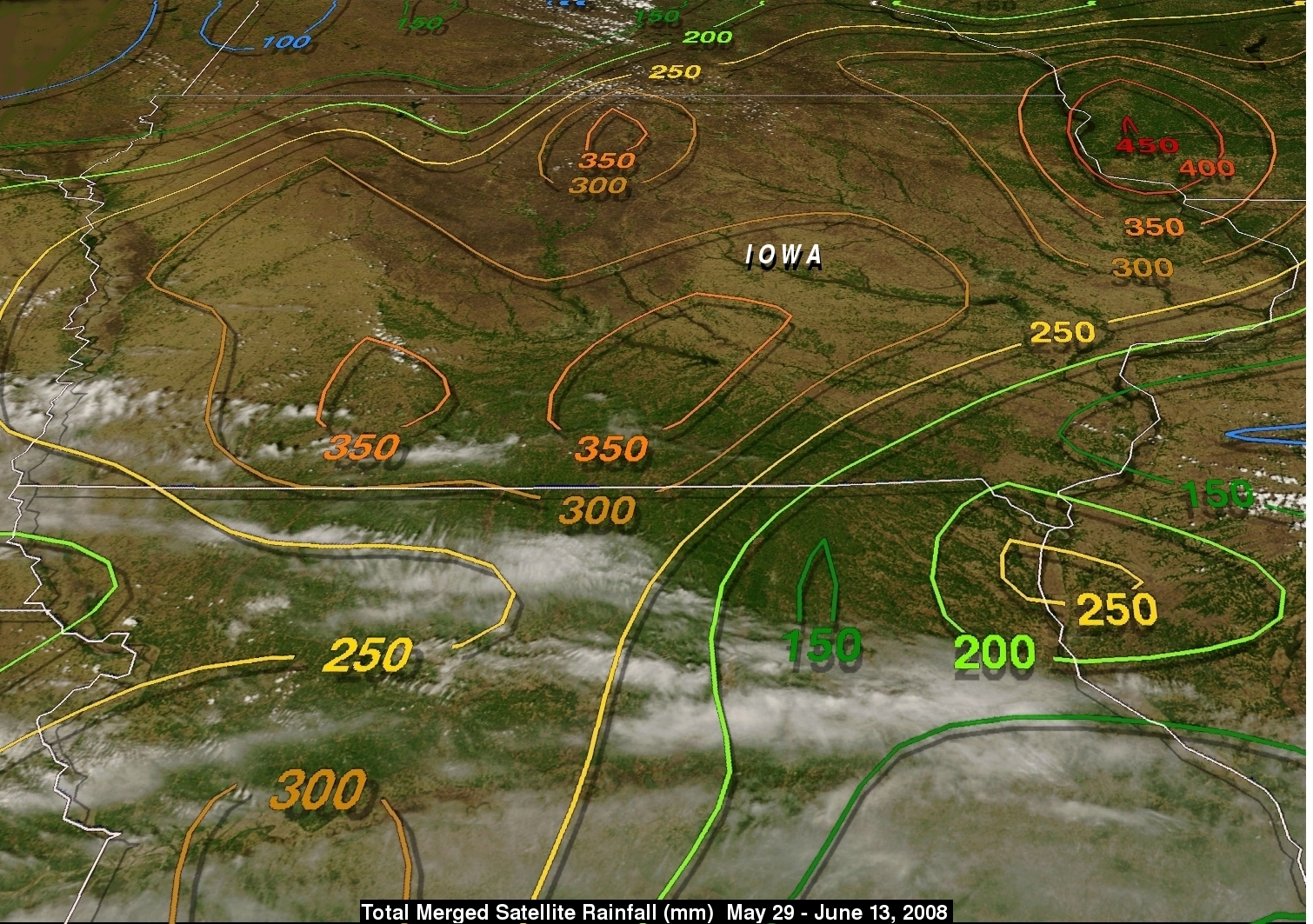
The Midwest was also hit by major flooding nearly five years ago as heavy rains fell from eastern Kansas up through Iowa and across southern Wisconsin into Michigan and over central Indiana and eastern Illinois during the first two weeks of June. Some of the hardest hit areas then were in Iowa where the Cedar River crested at 19 feet above flood stage near Cedar Rapids, flooding most of the downtown area.
As with the current situation, back in 2008 the heavy rains and flooding were due to low pressure developing near the Texas Panhandle and lifting northward into the Plains with Gulf moisture flowing northward on the east side of the low. However, back in 2008, the pattern was more persistent. The upper-level trough over the Rockies was slow to move and a strong Bermuda high-type area of high pressure was anchored over the southeastern US, helping to channel moisture up from the Gulf into the mid-section of the country, resulting in a more persistent moisture transport into the region over a longer period.