Southwest Indian Ocean Has Two Tropical Cyclones
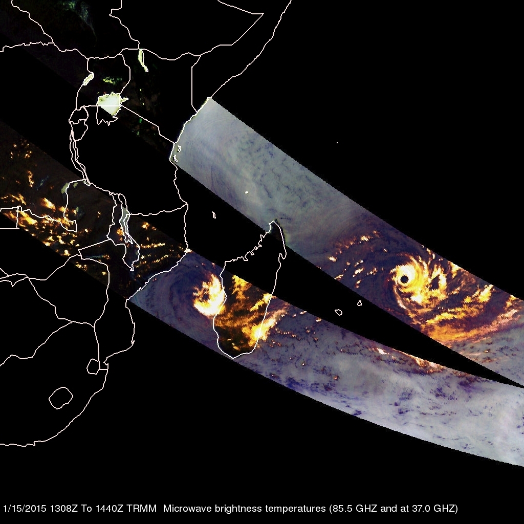
As tropical storm Mekkhala approaches the Philippines in the northern hemisphere tropical cyclone activity in the southeast Indian ocean has recently increased. The TRMM satellite has been monitoring rainfall in the tropics since 1997. On February 15, 2015 the TRMM satellite flew over two tropical cyclones in successive orbits.
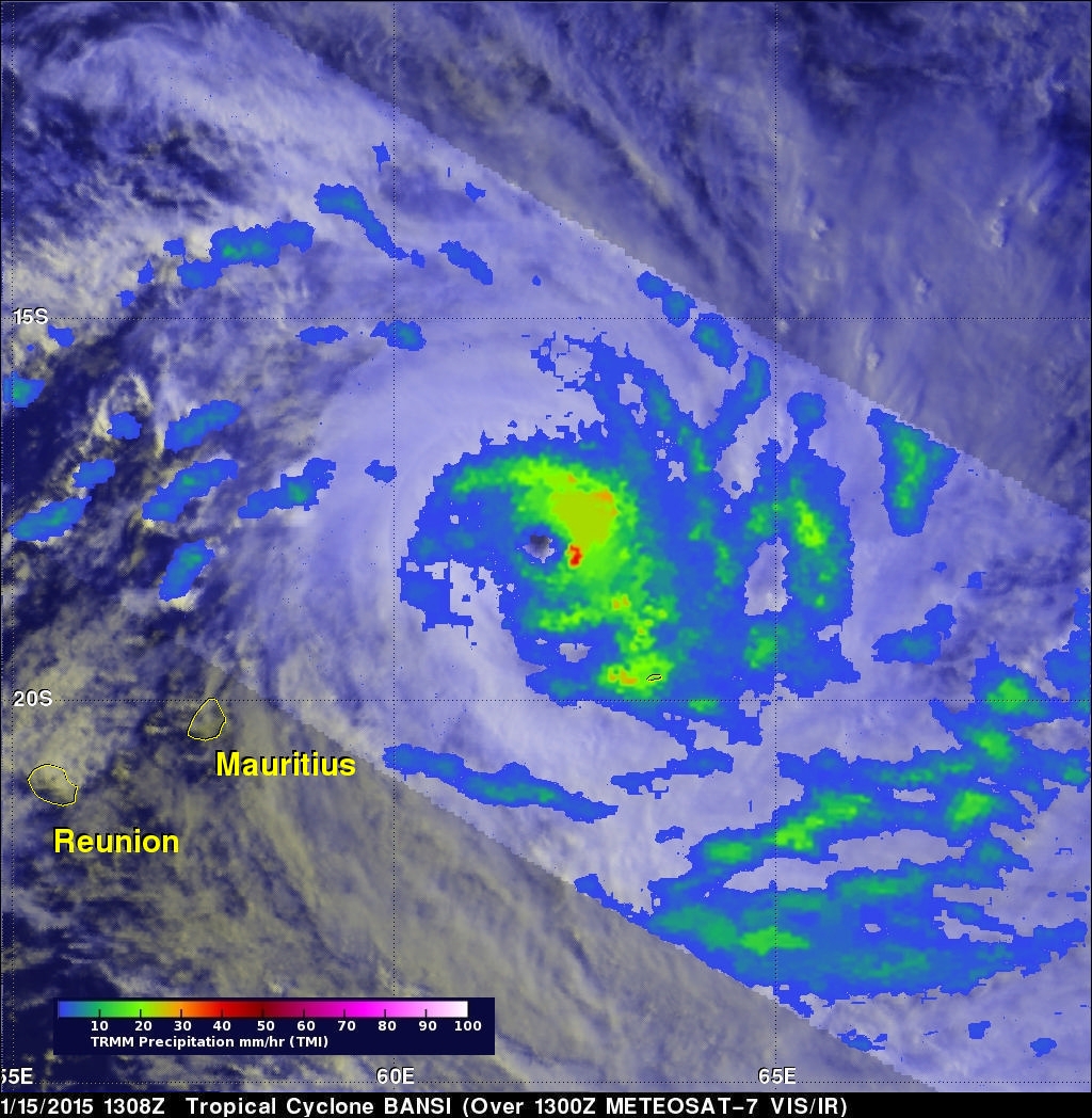
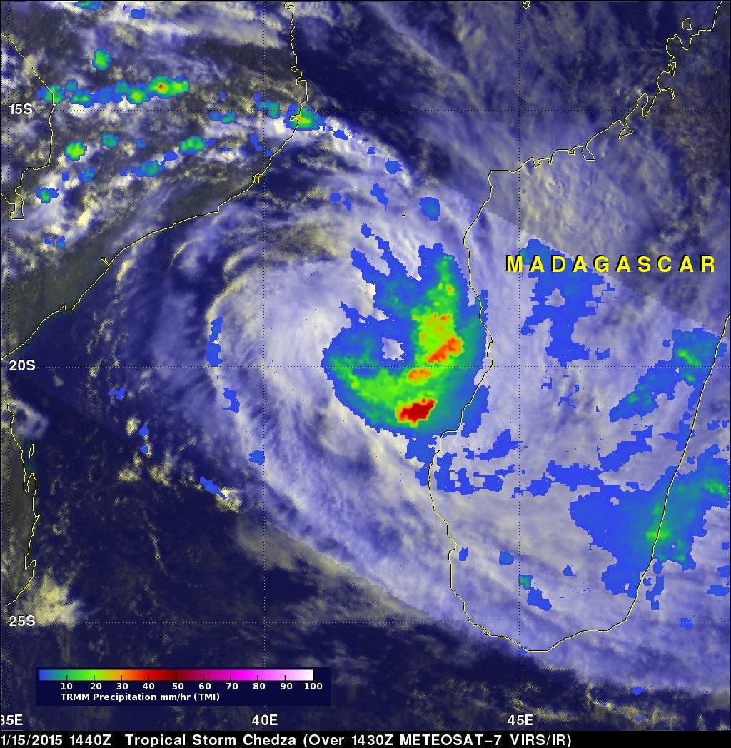
Rainfall derived from TRMM's Microwave Imager (TMI) is shown overlaid on a METEOSAT-7 Visble/Infrared images. On January 15, 2015 at 1308 UTC the satellite saw powerful category four tropical cyclone Bansi northeast of the Reunion and Mauritius islands. Bansi is predicted by the Joint Typhoon Warning Center (JTWC) to move toward the southeast over the open waters of the South Indian Ocean and weaken to tropical storm intensity in the next few days. Data collected by TRMM's Microwave Imager (TMI) with the next orbit on February 15, 2015 at 1440 UTC shows developing tropical storm Chedza nearing the western coast of Madagascar. Flash flooding is possible in central and southern Madagascar in the next couple days as Chedza crosses toward the southeast.


