
Super Typhoon Soulik Forms in the Pacific
Typhoon Soulik became the first super typhoon of the year when the Joint Typhoon Warning Center estimated that it's sustained winds had increased to 125 knots (~144 mph), which is equivalent to a Category 4 hurricane on the US Saffir-Simpson scale, at 00 UTC on the 10th of July. Soulik began as a tropical depression on the 8th (local time) about 120 miles (~195 km) east of the Northern Mariana Islands and quickly became a typhoon 24 hours later after moving westward into the Philippine Sea where it continued to intensify.
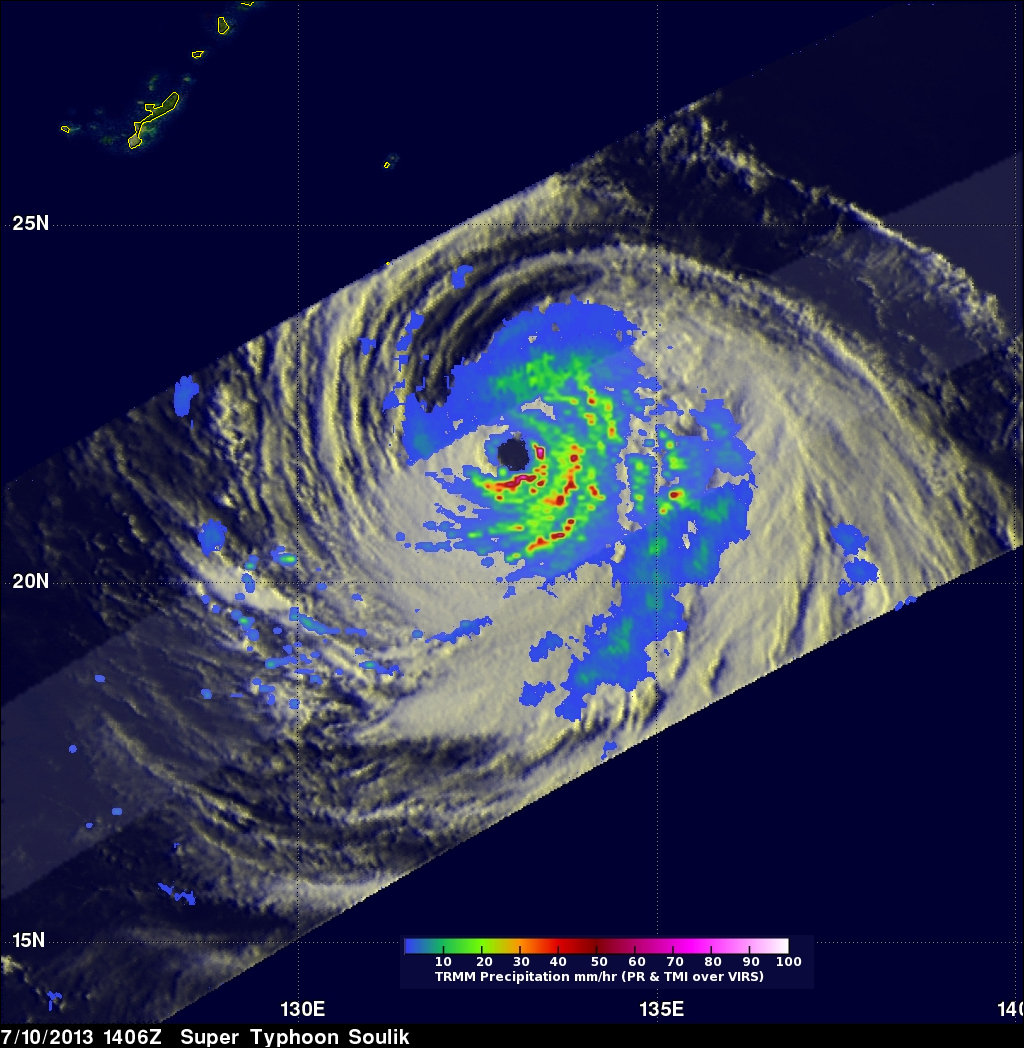
TRMM captured this latest image of Soulik in the central Philippine Sea about 800 miles (~1300 km) due east of Taiwan at 14:06 UTC 10 July (00:06 am 11 July local time) 2013. The image shows the horizontal distribution of rain intensity within the storm. Rain rates in the center of the swath are from the TRMM Precipitation Radar (PR), and those in the outer swath are from the TRMM Microwave Imager (TMI). The rain rates are overlaid on infrared (IR) data from the TRMM Visible Infrared Scanner (VIRS). TRMM reveals that Soulik has all of the features of a powerful, mature tropical cyclone, including a well defined eye (dark hole in the center of the image) and multiple intense rain bands (red, green and blue areas indicating intense, moderate and weak rain intensity, respectively) that wrap tightly around the eye, which reflect the storm's strong cyclonic circulation.
Soulik is expected to continue moving in a general westward direction over the next couple of days and could impact Taiwan before continuing on towards mainland China.