Super Typhoon Usagi Threatens The Philippines and Taiwan
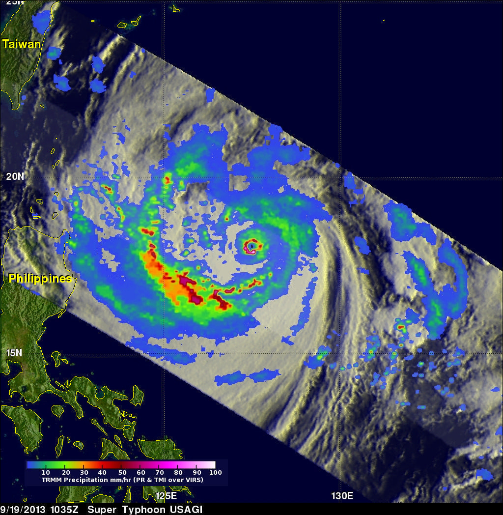
The most powerful typhoon of 2013 may affect the northern Philippines and southern Taiwan. What is now super typhoon USAGI formed in the open waters of the Philippine Sea about 1,000 km (~620 miles) east of the Philippines on September 16, 2013. USAGI rapidly intensified and became a typhoon yesterday. Super Typhoon USAGI had estimated maximum winds of close to 140kts (~161 mph) when the TRMM satellite had an excellent view on September 19, 2013 at 1035 UTC. A precipitation analysis from TRMM's Microwave Imager (TMI) and Precipitation Radar (PR) instruments is shown on the left overlaid on an enhanced infrared image from TRMM's Visible and InfraRed Scanner (VIRS). The most striking feature on this image is the small clear eye. Rain was measured by TRMM's PR instrument falling at a rate of over 140mm/hr (~5.5 inches) in the powerful storms within super typhoon USAGI's eye wall.
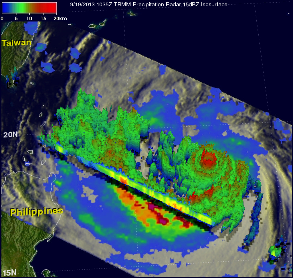
TRMM's Precipitation Radar (PR) can provide 3-D vertical profiles of rain and snow from the surface up to a height of about 12 miles (20 kilometers). A 3-D view of the vertical structure near USAGI's eye is shown on the right above. TRMM PR found that the violent storms in USAGI's eye wall were consistently reaching heights of over 15km (~9.3 miles). A few storms found in a feeder band spiraling into USAGI from the south were reaching even higher heights of over 16km (~9.9 miles).
The latest Joint Typhoon Warning Center (JTWC) forecast projects that USAGI will pass north of the Philippines in the next couple days and then pass very close to the southern tip of Taiwan on September 21, 2013. This path exposes southern Taiwan to the most dangerous part of the typhoon.