TD11 Upgraded To Tropical Storm Jerry
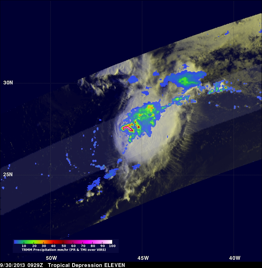
At 1500 UTC (11:00 AM EDT) the National Hurricane Center (NHC) upgraded TD11 to tropical storm Jerry. Tropical Depression ELEVEN (TD11) developed in the central Atlantic Ocean on Saturday September 28, 2013. Southwesterly wind shear reduced TD11's strengthening until this morning. TD11 was having strong bursts of convection when the TRMM satellite flew over earlier at 0929 UTC (~ 6:29 AM Local Time). The image on the left shows a rainfall analysis that uses TRMM Precipitation Radar (PR) data from that orbit. It shows that rain was falling at a rate of over 150 mm/hr from some powerful convective storms within TD11. Intense rainfall within these storms was returning radar reflectivity values of over 58dBZ to TRMM's Precipitation Radar (PR) instrument.
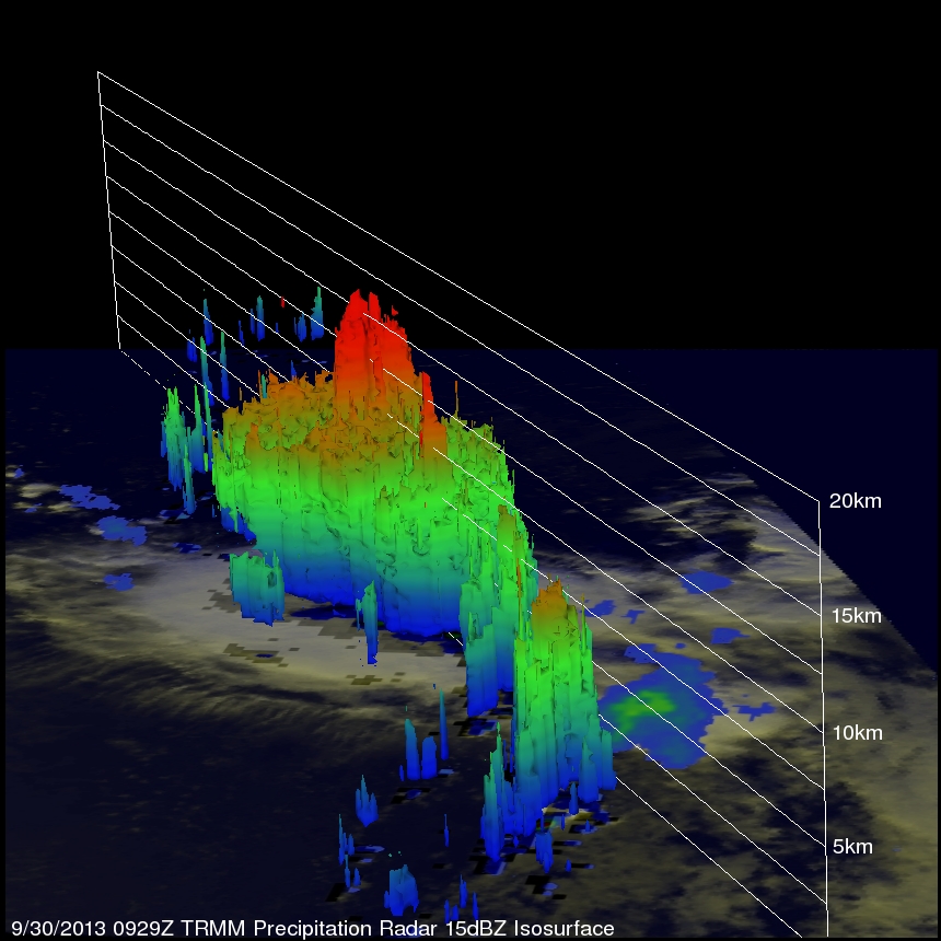
TRMM PR data were used in the image below to show a 3-D view of TD11's vertical structure. Several of the powerful storms in TD11's southwestern side were found by TRMM PR to reach heights above 16km (~9.9 miles). These towering convective storms are often a sign that a tropical cyclone is intensifying.