
Tornadoes Devastate Parts of the Great Plains
It's springtime in the Plains, which means the increased likelihood that severe weather, including tornadoes, will occur somewhere across the region. After a week of relative quiet, a strong storm system moved out of the southern Rockies and out into the Central Plains. In association with this system, strong southerly winds at low levels drew Gulf moisture up across Texas and into Oklahoma and Kansas while strong jet-stream winds aloft raced northeastward around the base of an upper-level trough over the four-corners region and out over the Plains, setting the stage for a potential severe weather outbreak in the heart of Tornado Alley.
On the 13th of April, a single EF1 tornado was reported. It moved through Norman, Oklahoma, home of the Storm Prediction Center, which is responsible for issuing tornado watches, where it injured 20 people. The peak of the outbreak occurred the following day when numerous tornadoes were reported across Kansas, Oklahoma, Iowa and Nebraska. Worst hit was Oklahoma where an EF3 tornado, a category 3 tornado on the Enhanced Fujita tornado scale with winds of up to 165 mph, struck the town of Woodward, Oklahoma in the northwestern part of the state, killing 6 people.
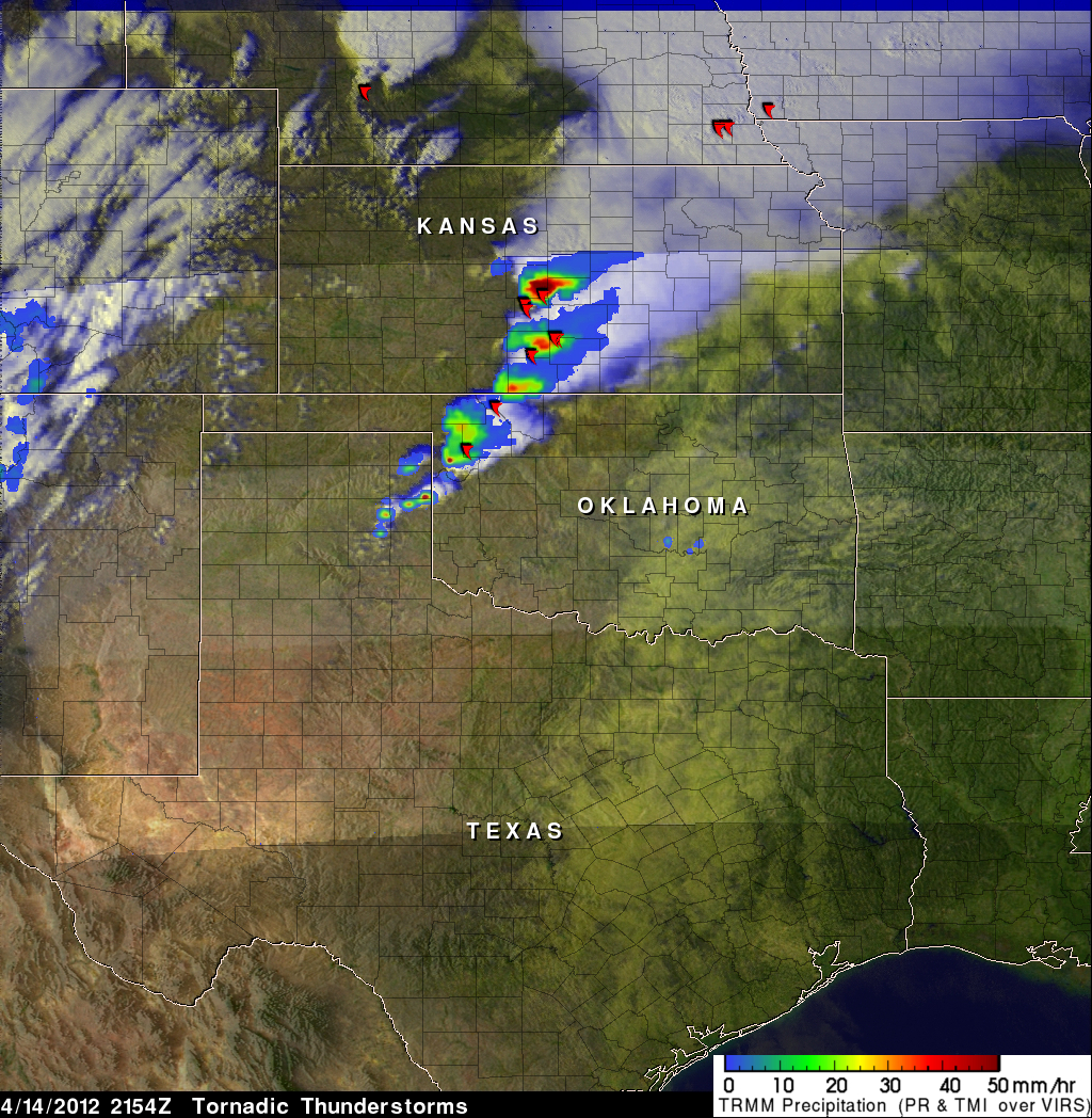
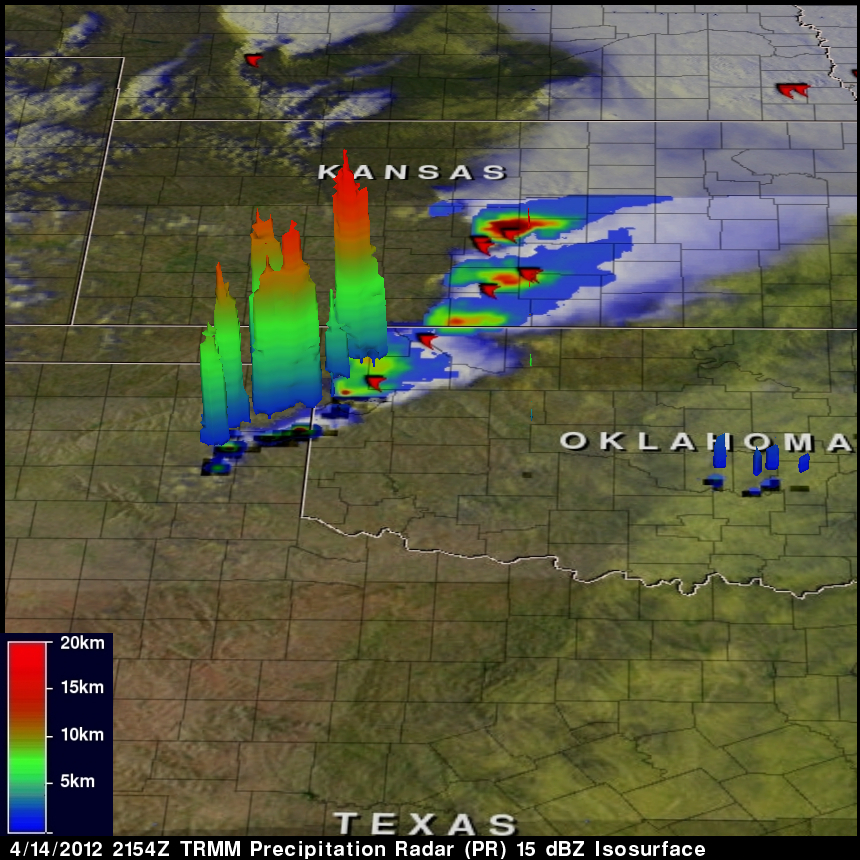
The Tropical Rainfall Measuring Mission satellite (known as TRMM) uses a combination of passive microwave and active radar sensors to measure rainfall from space, including the first and only space-borne precipitation radar--the TRMM PR. This first image was taken by TRMM at 21:54 UTC (4:54 pm CDT) 14 April 2012 and shows an instantaneous snap shot of the rain intensities within a line of strong storms stretching from the northeast corner of the Texas panhandle across northwestern Oklahoma and into central Kansas. Rain rates in the center of the swath are from the TRMM PR, while those in the outer swath are from the TRMM Microwave Imager (TMI). The rain rates are overlaid on visible-infrared (IR) data from the TRMM Visible Infrared Scanner (VIRS) within TRMM's swath with GOES data shown outside the TRMM swath.
The storms over Texas are still in their developing stage and appear rather small, though small areas of intense precipitation (dark red spots) are evident in their cores. Farther to the north, the storms over Kansas resemble mature super cell storms with large intense cores containing heavy precipitation (red and dark red areas) joined to broader areas of weak precipitation (blue areas) emanating northeastward from the convective cores in response to the strong upper-level jet stream winds. Super cells are long-lasting rotating thunderstorms capable of producing tornadoes. Red tornado symbols mark the locations of tornadoes that were reported within a half hour of the time the image was taken, showing that the storms over Kansas and Oklahoma were indeed tornadic.