
TRMM Monitors Southern Mexico's Rainfall
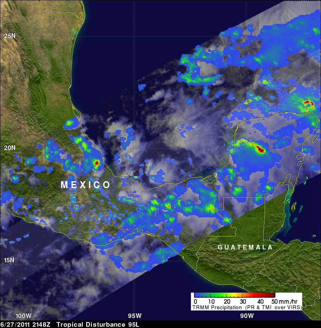
The TRMM satellite flew over an area of disturbed weather labeled 95L affecting southern Mexico on 27 June 2011 at 2148 UTC (5:48 PM EDT). The TRMM rainfall analysis shown above used TRMM's Microwave Imager (TMI) and Precipitation Radar (PR) data. It shows that heavy rainfall of over 50mm (~2 inches) associated with 95L was occurring in southern Mexico northwest of Veracruz and over the Yucatan Peninsula. Some of this very heavy rainfall may result in flash flooding and mudslides.
The National Hurricane Center (NHC) is watching this area and has indicated that there is a slight chance that a tropical cyclone will develop there.