
TRMM Monitors Super Typhoon Francisco
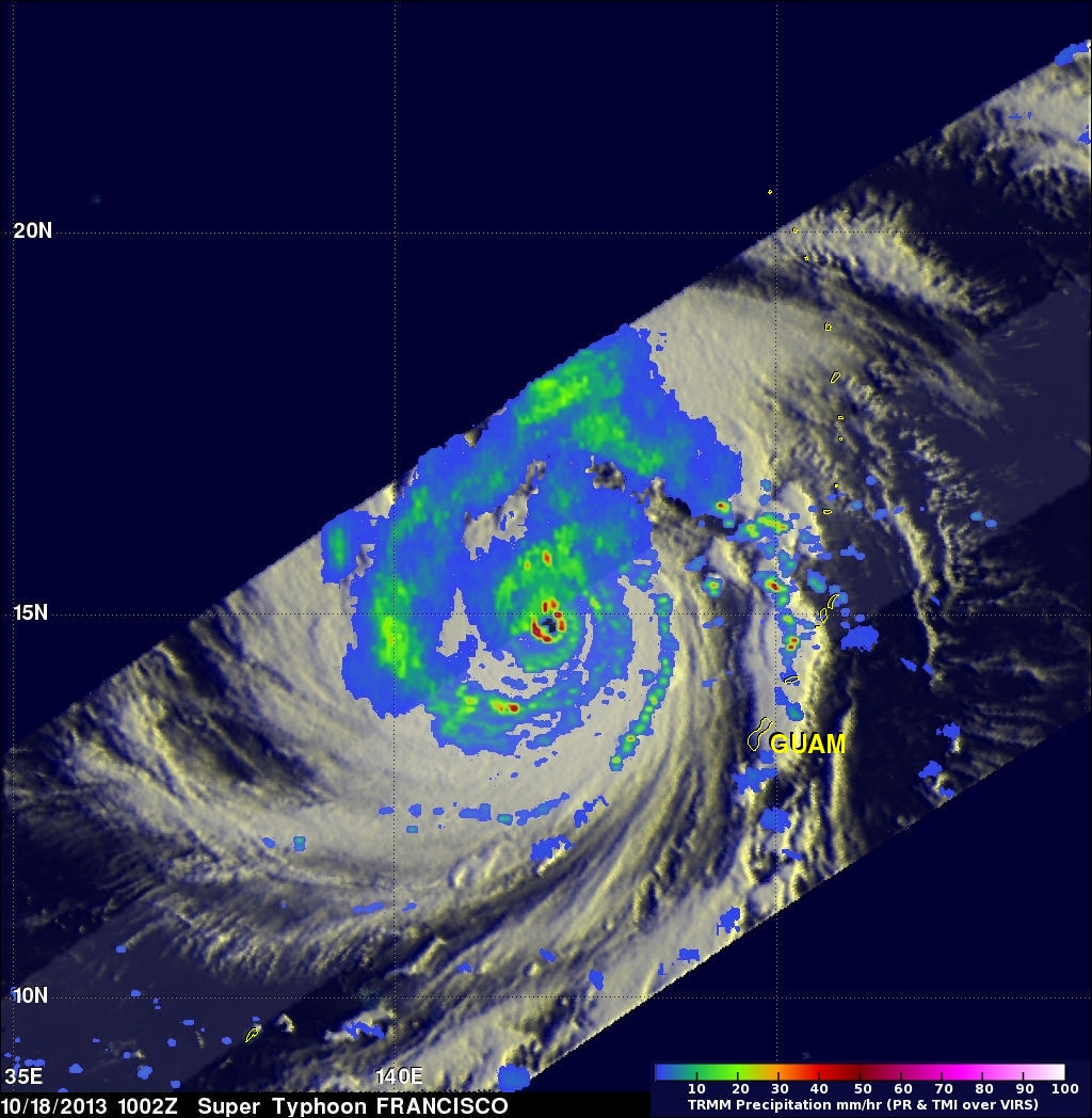
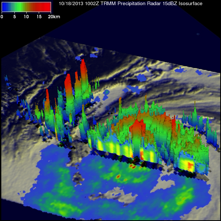
The sixth super typhoon of 2013 called Francisco developed in the Western Pacific Ocean on October 16, 2013. The image on the left was made from data collected as the TRMM satellite passed over on October 18, 2013 at 1002 UTC when super typhoon Francisco was located west-northwest of Guam. A rainfall analysis that used data from TRMM's Microwave Imager (TMI) and Precipitation Radar (PR) instruments is shown on the left overlaid on an enhanced infrared image from TRMM's Visible and InfraRed Scanner (VIRS). TRMM PR found that rain was falling at a rate of over 113 mm/hr (~4.5 inches) in powerful storms within Francisco's distinct eye wall. The image on the right shows a simulated 3-D cutaway view of super typhoon Francisco using data from TRMM's Precipitation Radar (PR) instrument.
A typhoon called Wipha that hit Japan only a few days ago approached from the same area of the Pacific Ocean. Typhoon Wipha caused flooding, landslides and the reported deaths of at least 19 people.