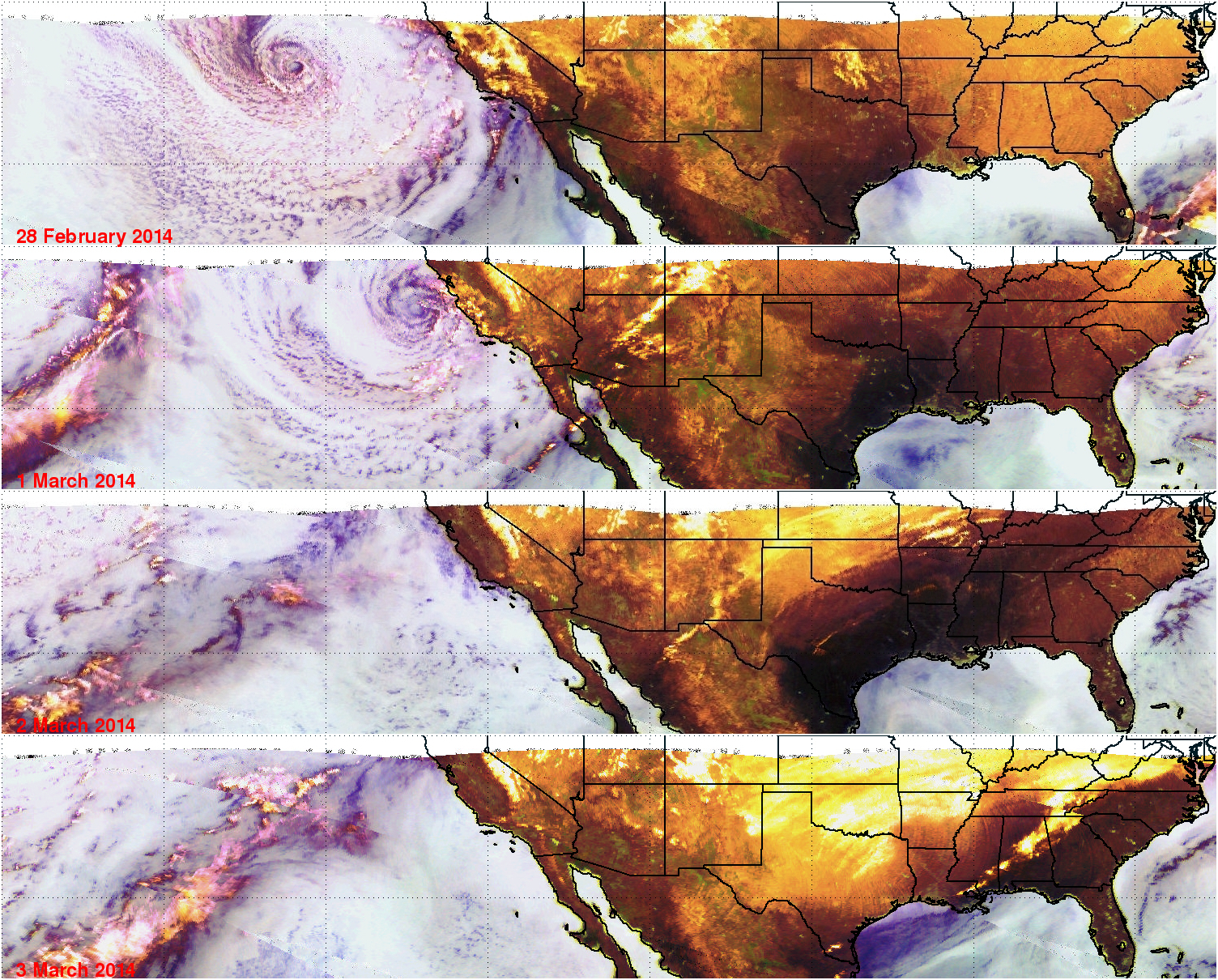
TRMM Observes Storm Moving From California Eastward
Images are routinely produced using TRMM Microwave Imager (TMI) data which show the global area covered by the satellite. These "Quick Look" images use Microwave brightness temperatures at 85.5 GHZ and at 37.0 GHZ combined in the red, green and blue components (guns) of the images. These false color images can be used to distinguish land from water and show the differences between land surfaces such as deserts, snow cover and sea ice. On these images areas of dry atmosphere over water appear as blue and moist atmosphere is dark blue. Snow cover over land appears as white or grey, deserts are green. Scattering (by cloud ice) is shown as yellow.
The image above shows TRMM Microwave Imager (TMI) views of the movement of recent stormy weather from California's Pacific Ocean coast to the Atlantic Coast. The first TRMM TMI (28 February 2014) image shows a large low pressure center in the Pacific Ocean moving toward California. Rain associated with this storm dropped over four inches of rain in Los Angeles that resulted in evacuation orders. The center of the storm was just off the California coast the next day(1 March 2014) and precipitation had also moved into Arizona. By Sunday (2 March 2014) precipitation in the form of rain, freezing rain and snow was extending from New Mexico through the Ohio valley. On Monday (3 March 2014) TRMM's TMI instrument showed precipitation (yellow) and snow cover (white/yellow) over large areas of the eastern United States.
Click here to see a Low Resolution 640x128 Quicktime animation .
Click here to see a Low Resolution 640x128 MPEG animation.
For more information about using Microwave brightness temperatures to distinguish between land, water and precipitation see "Negri, Andrew J., Robert F. Adler, Christian D. Kummerow, 1989: False-Color Display of Special Sensor Microwave/Imager (SSM/I) Data. Bulletin of the American Meteorological Society: Vol. 70, No. 2, pp. 146–151."
Images and Captions by Hal Pierce (SSAI/NASA GSFC)


