
TRMM PR Slices Through Sean
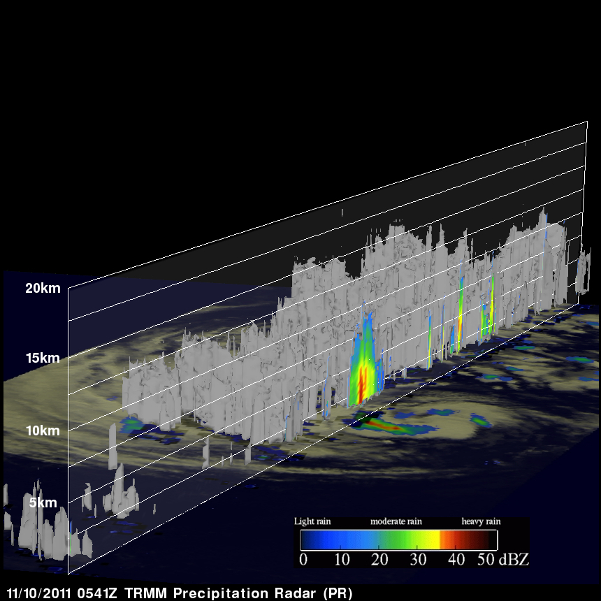
The TRMM satellite had a good look at tropical storm Sean when it flew over on 10 November 2011 at 0541 UTC (00:41 AM EST). TRMM's Precipitation Radar (PR) data were used in the image above to show a 3-D cross section through Sean. TRMM's PR revealed that heights of storms in the edge of Sean's center of circulation were reaching to about 11km (~6.8 miles). Radar Reflectivity values of up to 46.0 dBZ found in these storms also showed that rainfall was heavy in that area.
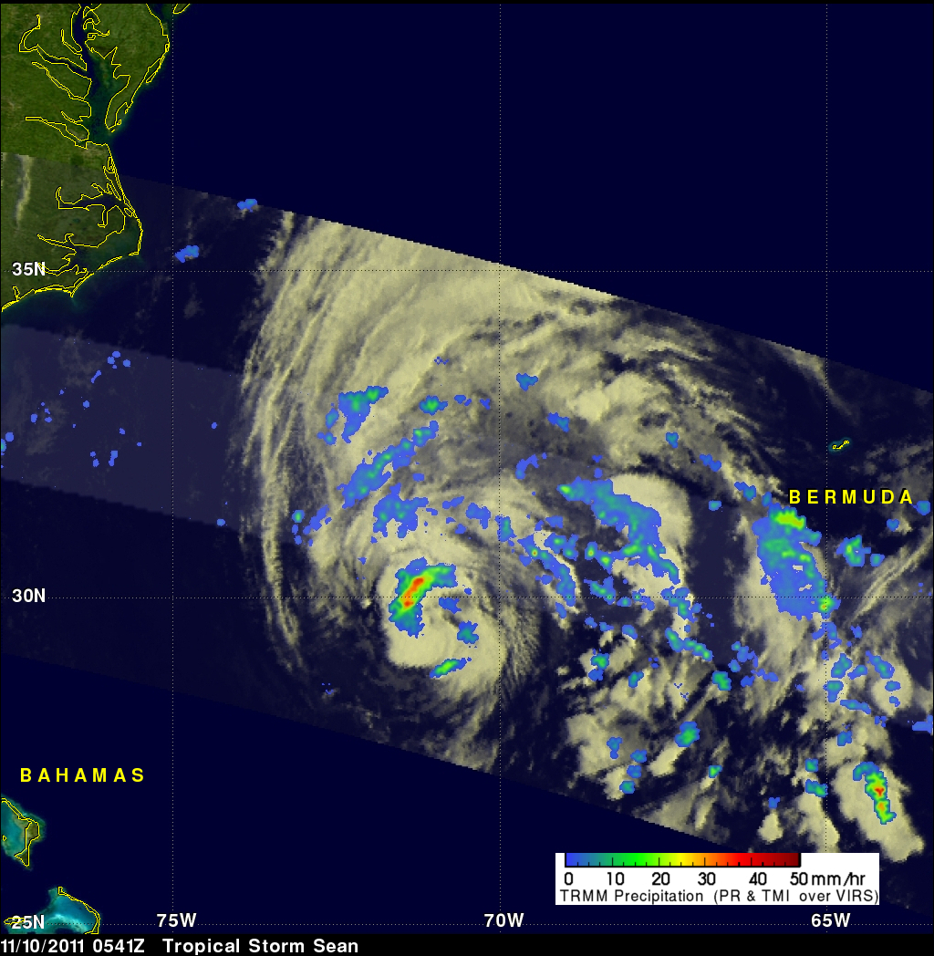
The "top down" satellite view above shows that those storms in Sean's northwestern quadrant were the most powerful. The rest of Sean contained bands of widely scattered light to occasionally moderate rainfall.
Sean is predicted by the National Hurricane Center (NHC) to pass well to the northwest of Bermuda on Friday 11 November 2011. The storm will then encounter cooler ocean waters and increased wind shear resulting in the storm becoming extratropical.
Click here to see earlier TRMM information about tropical storm Sean