
TRMM Precipitation Radar Sees Two Tropical Storms Developing
The TRMM satellite saw two tropical storms in the western Pacific Ocean as they were in early stages of development. These 3-D views were made from TRMM's Precipitation Radar (PR) data collected on 25 July 2011 at 1631 UTC and 26 July 2011 at 0049 UTC. Those data show that developing tropical storms NOCK-TEN (10W) and 11W both had towering convective storms near their centers of circulation that extended to heights above 15km (~9.3 miles).
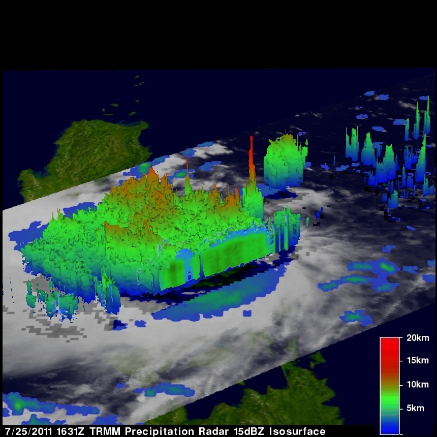
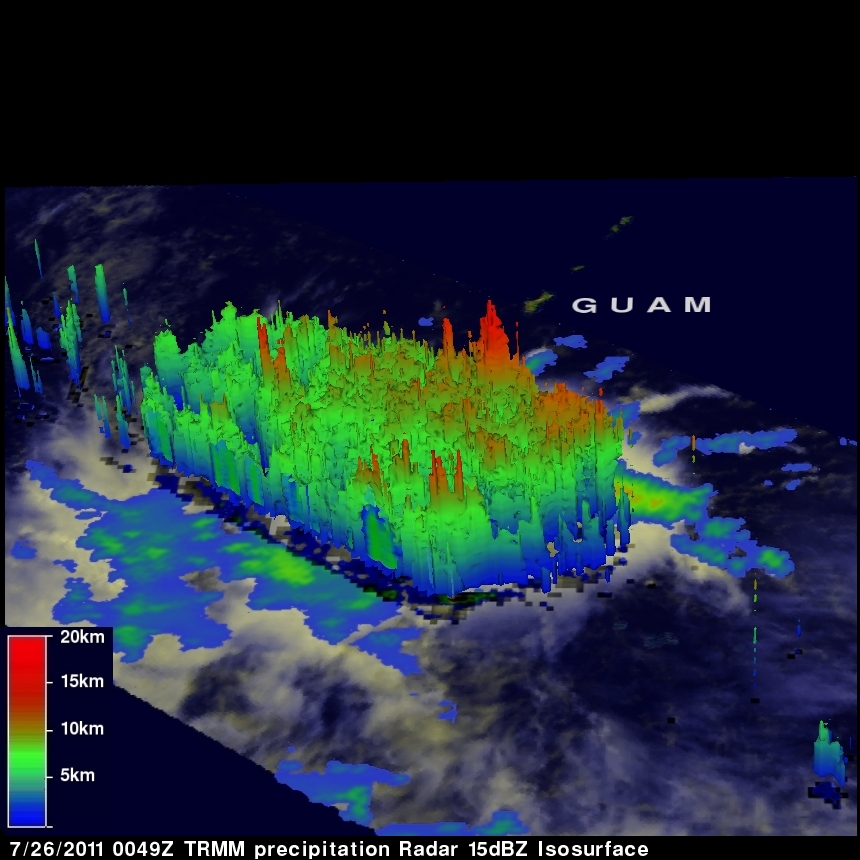
These tall towers are associated with convective bursts and can be a sign of future strengthening because they indicate areas where energy is being released into the developing tropical storms. Tropical storm NOCK-TEN is shown when it was was effecting the eastern Philippines and 11W was viewed when it was forming south of Guam.