TRMM Satellite Shows Possible Storm Development
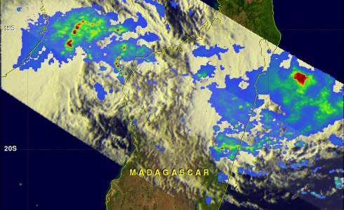
The TRMM satellite had another revealing pass over the Mozambique Channel and Madagascar on 27 February 2012 at 2011 UTC. This area is being monitored for significant tropical cyclone development. TRMM's Microwave Imager (TMI) and Precipitation Radar (PR) data were used in the rainfall analysis on the upper left. This analysis shows that very intense storms were being produced by a cyclonic circulation off northwestern Mozambique. These storms were dropping rainfall at a rate of over 50mm/hr (~2 inches) in the Mozambique Channel between Mozambique and Madagascar.
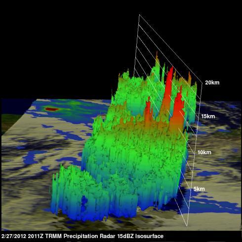
The 3-D TRMM PR image on the upper right reveals that some powerful storm towers in the Mozambique Channel were pushing to heights of about 17.5 km (10.9 miles).


