
TRMM Sees Another Tropical Cyclone Developing
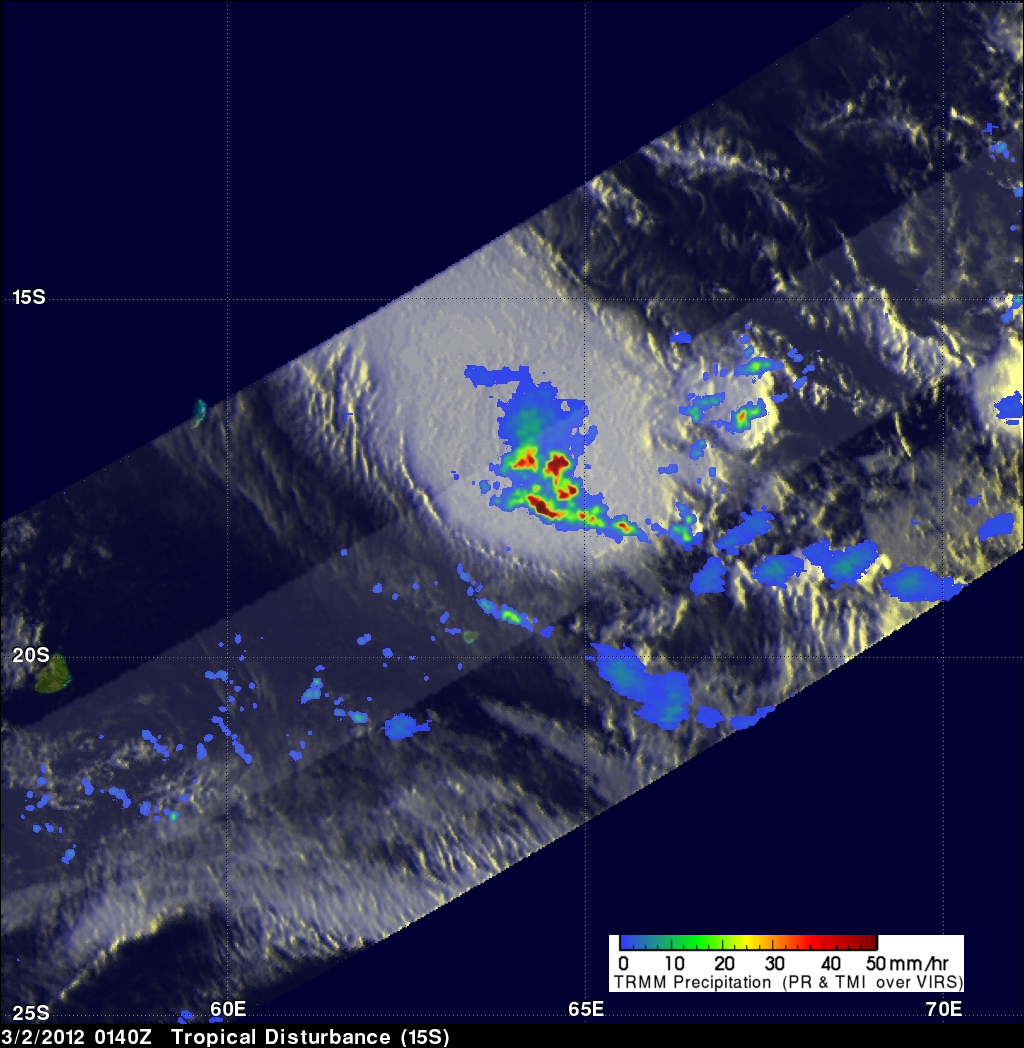
This has been an active tropical cyclone season in the South Indian Ocean. The TRMM satellite passed over another forming tropical cyclone (15s) in the South Indian Ocean on 2 March 2012 at 0140 UTC. A rainfall analysis from TRMM's Microwave Imager (TMI) and Precipitation Radar (PR) instruments is shown on the image above. This "top down" view shows that very heavy rainfall of over 50mm/hr (~2 inches) was occurring near the center of the storm's circulation.
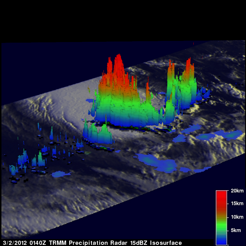
TRMM's Precipitation Radar (PR) was used in the image above to show the 3-D structure of the forming tropical cyclone. Powerful storm towers in the middle of the tropical cyclone were shown by PR to reach heights of over 17.5 (~10.9 miles). Another indication of heavy rainfall was that radar reflectivity values of 53.770 dBz were found in this area of the tropical cyclone.
Tropical cyclone 15S hasn't been predicted to have winds greater than 30kts (~34.5 mph) as it heads toward the southeast over the open waters of the South Indian Ocean.