
TRMM Sees Arlene Threatening Mexico
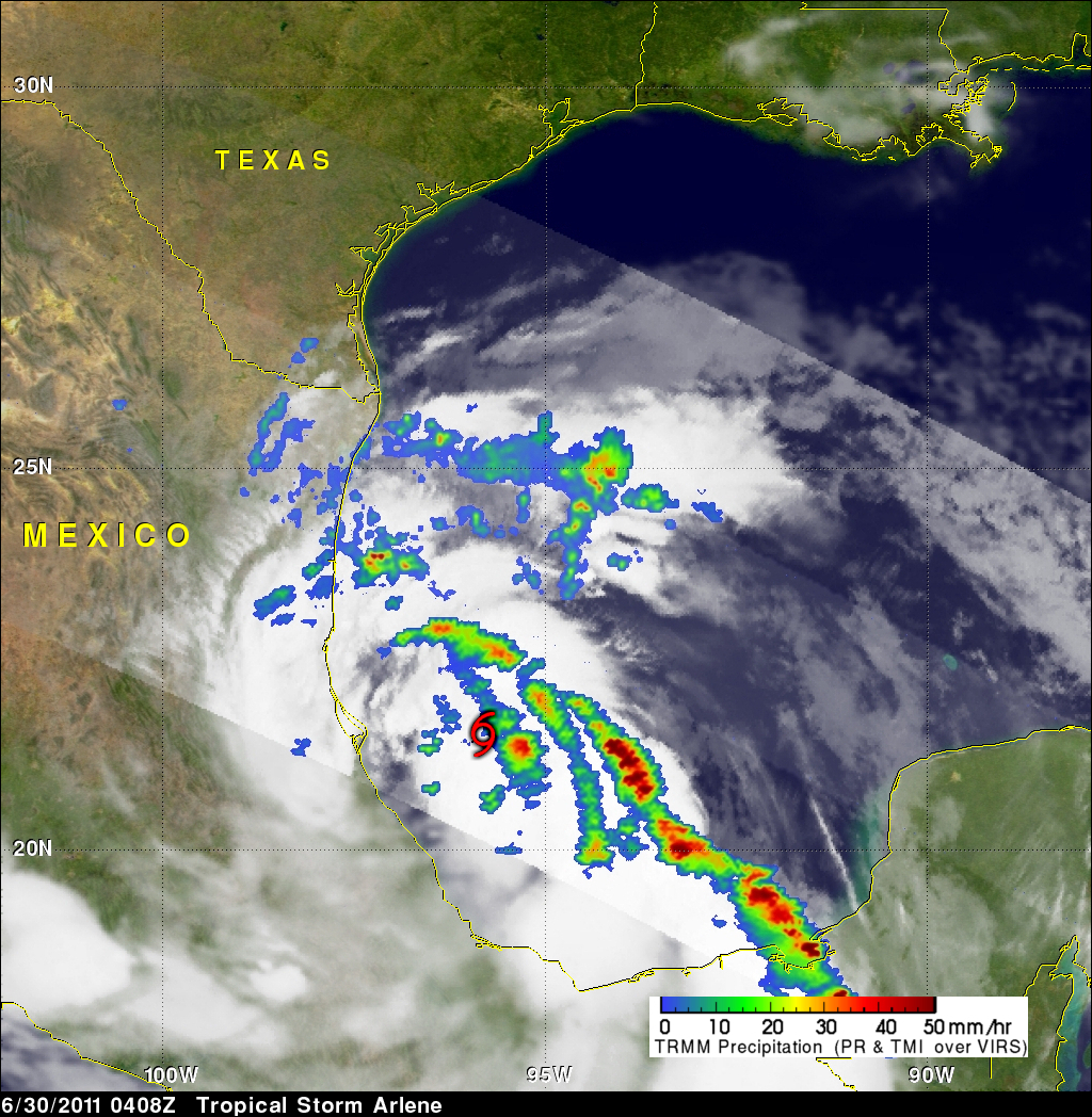
The TRMM satellite again flew over tropical storm Arlene on 30 June 2011 at 0408 UTC before the first tropical storm of the Atlantic hurricane season came ashore in Mexico. Arlene had become a strong tropical storm with sustained winds of about 55 kts (~63 mph). The rainfall analysis above is from TRMM's Microwave Imager (TMI) and Precipitation Radar (PR). It shows that Arlene contained areas of very heavy rainfall. A few rain showers from Arlene were starting to reach Mexico and extreme southern Texas but at that time the most intense storms were still located in the Gulf Of Mexico east of the storm's center of circulation. The approximate center of the storm is shown with a red tropical storm symbol. An infrared image from the GOES-EAST satellite received at about the same time was used to fill in areas not viewed by the TRMM satellite. Click here to see earlier TRMM information about tropical storm Arlene.